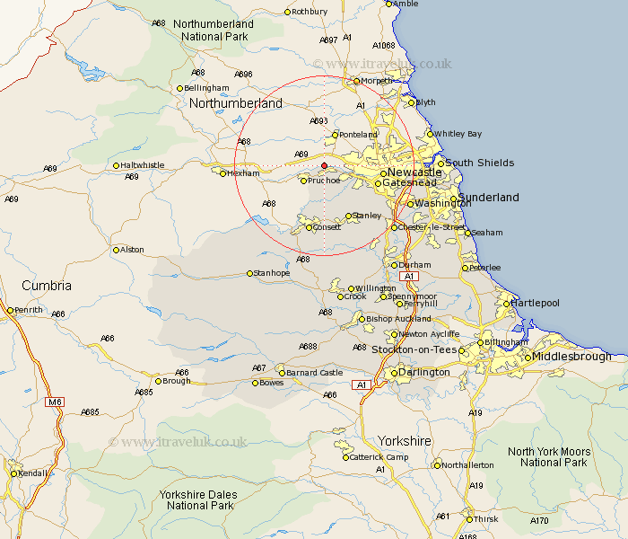
Durham Map Showing Location of Heddon On The Wall
District: Gateshead
Easting: 413864 Northing: 565440
Latitude: 54.98 Longitude: -1.78
 = Heddon On The Wall
Easting: 413864 Northing: 565440
Latitude: 54.98 Longitude: -1.78
= Heddon On The Wall
This Heddon On The Wall map below is supplied by Google. Use the tools in the top left corner to zoom into street level or zoom out for a road map, you may also need to zoom in to see Heddon On The Wall on the map. Click and drag the map to move around. If the map fails to load try and refresh your browser or zoom in or out (+ or -).
Update - it seems Google no longer allow people to use their maps for free! This Heddon On The Wall map sometimes loads and sometimes gives a error. I am working on a solution.
Closest 30 Towns or Cities to Heddon On The Wall (Population over 500)
Blaydon 5.63km Rowlands Gill 8.06km Whickham 8.47km Burnopfield 10.19km Gateshead-on-Tyne 11.41km Gateshead on Tyne 11.41km Gateshead 11.41km Leadgate 13.01km Stanley 13.08km Lamesley 13.85km Felling 14.6km Consett 15.16km Consetti 15.16km Annfield Plain 15.16km Ouston Moor 15.24km Ouston 15.24km Hebburn on Tyne 17.12km Hebburn 17.12km Hebburn-on-Tyne 17.12km Pelton 17.47km Castleside 17.51km Edmondsley 17.65km Birtley 17.75km Lanchester 18.8km Washington New Town 19.39km Washington 19.39km Chester-le-Street 20.28km Boldon 20.55km West Boldon 20.55km Jarrow-on-Tyne 21.22km