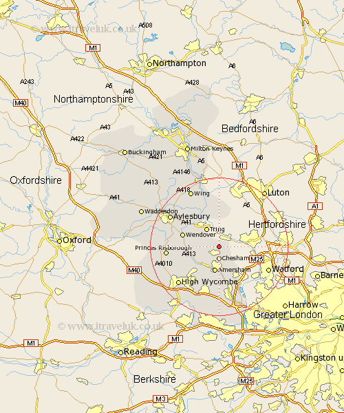
Buckinghamshire Map Showing Location of Hawridge
District: Chiltern
Easting: 496669 Northing: 204821
Latitude: 51.73 Longitude: -0.6
 = Hawridge
Easting: 496669 Northing: 204821
Latitude: 51.73 Longitude: -0.6
= Hawridge
This Hawridge map below is supplied by Google. Use the tools in the top left corner to zoom into street level or zoom out for a road map, you may also need to zoom in to see Hawridge on the map. Click and drag the map to move around. If the map fails to load try and refresh your browser or zoom in or out (+ or -).
Update - it seems Google no longer allow people to use their maps for free! This Hawridge map sometimes loads and sometimes gives a error. I am working on a solution.
Closest 30 Towns or Cities to Hawridge (Population over 500)
Chesham 3.7km Lee 6.03km Latimer 6.54km Amersham 7.49km Great Missenden 7.82km Little Missenden 8.72km Pitstone 9.34km Prestwood 9.9km Marsworth 10.35km Halton 10.73km Aston Clinton 10.93km Buckland 10.93km Wendover 10.97km Ivinghoe 11.18km Hazlemere 11.55km Weston Turville 11.73km Cheddington 12.03km Ellesborough 12.76km Edlesborough 13.03km Hughenden 13.05km Chalfont Saint Giles 13.17km Chalfont St. Giles 13.17km Chalfont St Giles 13.17km Kimble 13.77km Great Kimble 13.77km Stoke Mandeville 13.79km Penn 14.18km Beaconsfield 15km Slapton 15.01km Princes Risborough 15.04km