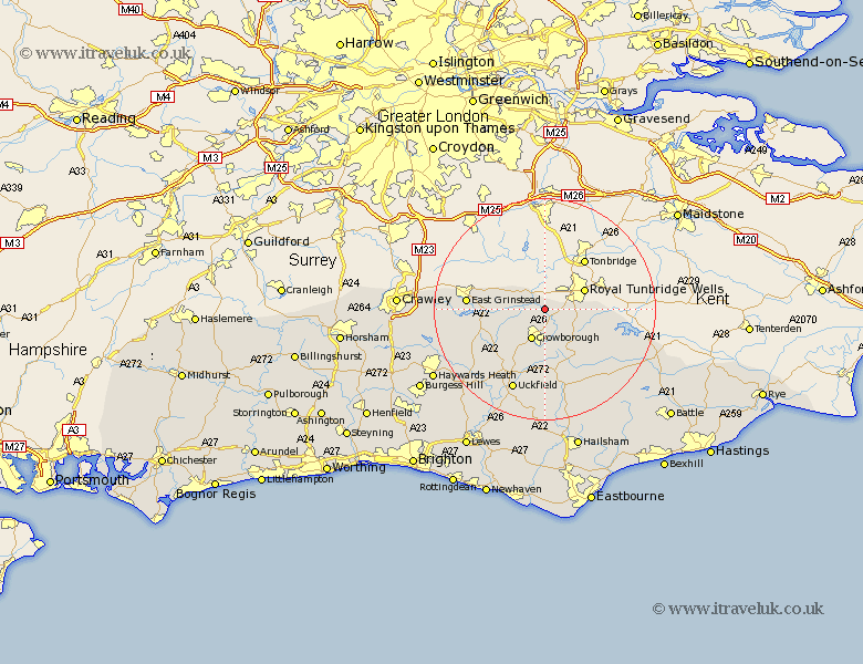
Sussex Map Showing Location of Groombridge
District: Wealden
Easting: 552851 Northing: 135736
Latitude: 51.1 Longitude: 0.18
 = Groombridge
Easting: 552851 Northing: 135736
Latitude: 51.1 Longitude: 0.18
= Groombridge
This Groombridge map below is supplied by Google. Use the tools in the top left corner to zoom into street level or zoom out for a road map, you may also need to zoom in to see Groombridge on the map. Click and drag the map to move around. If the map fails to load try and refresh your browser or zoom in or out (+ or -).
Update - it seems Google no longer allow people to use their maps for free! This Groombridge map sometimes loads and sometimes gives a error. I am working on a solution.
Closest 30 Towns or Cities to Groombridge (Population over 500)
Withyham 3.95km Hartfield 5.01km Crowborough 6.03km Frant 6.11km Rotherfield 7.77km Wadhurst 11.86km Mayfield 12.06km Hadlow Down 12.98km Buxted 13.44km East Grinstead 14.09km Maresfield 14.74km Forest Row 15.24km Uckfield 15.93km Fletching 16.68km Horsted Keynes 16.77km Framfield 17.04km Heathfield 17.67km Burwash 17.86km Ticehurst 17.91km Turners Hill 18.72km Newick 18.86km Warbleton 19.81km Ardingly 20.06km Isfield 20.25km Chailey 20.35km East Hoathly 20.41km Etchingham 20.71km Lindfield 20.71km Horam 20.91km Horeham 20.91km