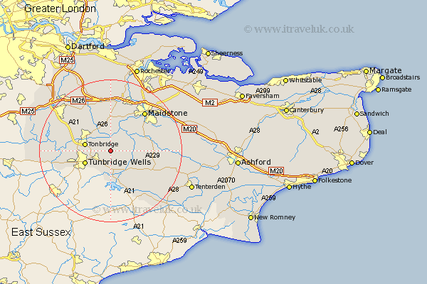
Kent Map Showing Location of Paddock Wood
Population: 6620
Area Size (ha): 171
District: Tunbridge Wells
Easting: 566611 Northing: 143586
Latitude: 51.17 Longitude: 0.38
 = Paddock Wood
Area Size (ha): 171
District: Tunbridge Wells
Easting: 566611 Northing: 143586
Latitude: 51.17 Longitude: 0.38
= Paddock Wood
This Paddock Wood map below is supplied by Google. Use the tools in the top left corner to zoom into street level or zoom out for a road map, you may also need to zoom in to see Paddock Wood on the map. Click and drag the map to move around. If the map fails to load try and refresh your browser or zoom in or out (+ or -).
Update - it seems Google no longer allow people to use their maps for free! This Paddock Wood map sometimes loads and sometimes gives a error. I am working on a solution.
Closest 30 Towns or Cities to Paddock Wood (Population over 500)
East Peckham 3.7km Brenchley 3.89km Pembury 5.95km Yalding 6.56km Hadlow 6.56km Horsmonden 6.56km Tonbridge 7.21km Hunton 7.89km Tunbridge Wells 7.9km Royal Tunbridge Wells 7.9km Turnbridge Wells 7.9km Marden 8.13km Goudhurst 8.75km Lamberhurst 9.27km Mereworth 9.33km Wateringbury 9.55km Staplehurst 10.62km Southborough 10.62km Bidborough 10.62km Linton 10.83km East Barming 10.93km Barming 10.93km Plaxtol 10.93km Hildenborough 11.09km East Malling 11.65km Leigh 11.77km Boughton Monchelsea 11.84km Loose 11.88km Speldhurst 12.2km Addington 13.02km