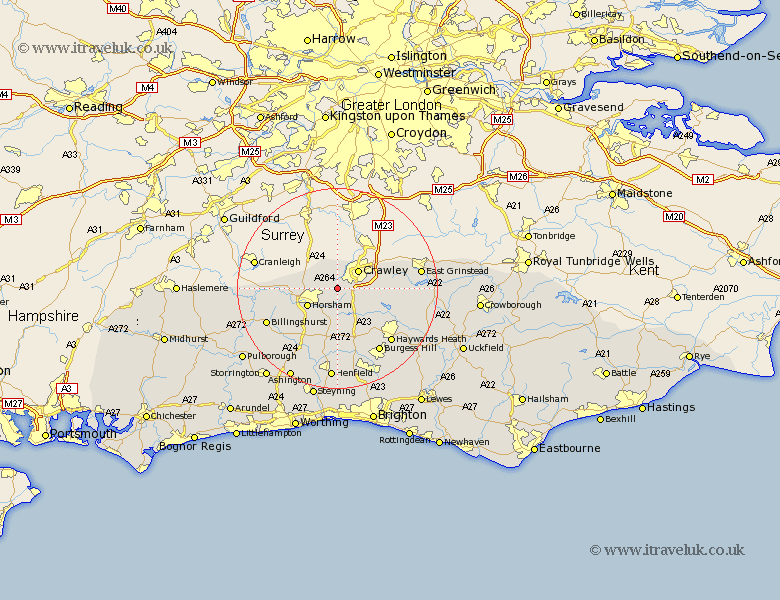
Sussex Map Showing Location of Faygate
District: Horsham
Easting: 522561 Northing: 133069
Latitude: 51.08 Longitude: -0.25
 = Faygate
Easting: 522561 Northing: 133069
Latitude: 51.08 Longitude: -0.25
= Faygate
This Faygate map below is supplied by Google. Use the tools in the top left corner to zoom into street level or zoom out for a road map, you may also need to zoom in to see Faygate on the map. Click and drag the map to move around. If the map fails to load try and refresh your browser or zoom in or out (+ or -).
Update - it seems Google no longer allow people to use their maps for free! This Faygate map sometimes loads and sometimes gives a error. I am working on a solution.
Closest 30 Towns or Cities to Faygate (Population over 500)
Rusper 2.19km Crawley 5.43km Warnham 5.82km Slaugham 6.57km Horsham 6.9km West Horsham 6.9km Lower Beeding 7.41km Worth 8.36km Nuthurst 9.9km Balcombe 10.03km Southwater 10.18km Itchingfield 10.85km Cuckfield 11.02km South Nutfield 11.02km Slinfold 11.12km Cowfold 11.18km Turners Hill 11.64km Bolney 11.66km Botney 11.66km Ardingly 12.91km Rudgwick 12.94km West Grinstead 14.22km Forest Row 15.13km Baywards Heath 15.29km Haywards Heath 15.29km Shipley 15.32km Burgess Hill 15.32km Lindfield 15.81km Billingshurst 15.82km East Grinstead 16.71km