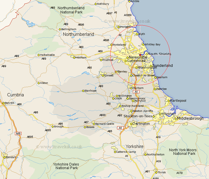
Durham Map Showing Location of East Howdon
District: South Tyneside
Easting: 433060 Northing: 565541
Latitude: 54.98 Longitude: -1.48
 = East Howdon
Easting: 433060 Northing: 565541
Latitude: 54.98 Longitude: -1.48
= East Howdon
This East Howdon map below is supplied by Google. Use the tools in the top left corner to zoom into street level or zoom out for a road map, you may also need to zoom in to see East Howdon on the map. Click and drag the map to move around. If the map fails to load try and refresh your browser or zoom in or out (+ or -).
Update - it seems Google no longer allow people to use their maps for free! This East Howdon map sometimes loads and sometimes gives a error. I am working on a solution.
Closest 30 Towns or Cities to East Howdon (Population over 500)
Jarrow 2.1km Jarrow-on-Tyne 2.1km Jarrow on Tyne 2.1km Hebburn on Tyne 2.82km Hebburn-on-Tyne 2.82km Hebburn 2.82km Boldon 3.85km West Boldon 3.85km Felling 5.82km Marsden 7.67km Whitburn 8.05km Washington 9.5km Washington New Town 9.5km Gateshead-on-Tyne 9.57km Gateshead on Tyne 9.57km Gateshead 9.57km Sunderland 10.19km Lamesley 10.5km Birtley 12.33km Ouston Moor 13.25km Ouston 13.25km Whickham 13.93km Blaydon 13.95km Houghton le Spring 14.86km Pelton 14.96km Chester-le-Street 15.75km Burnopfield 17.55km Rowlands Gill 17.6km Edmondsley 17.65km Seaton 17.86km