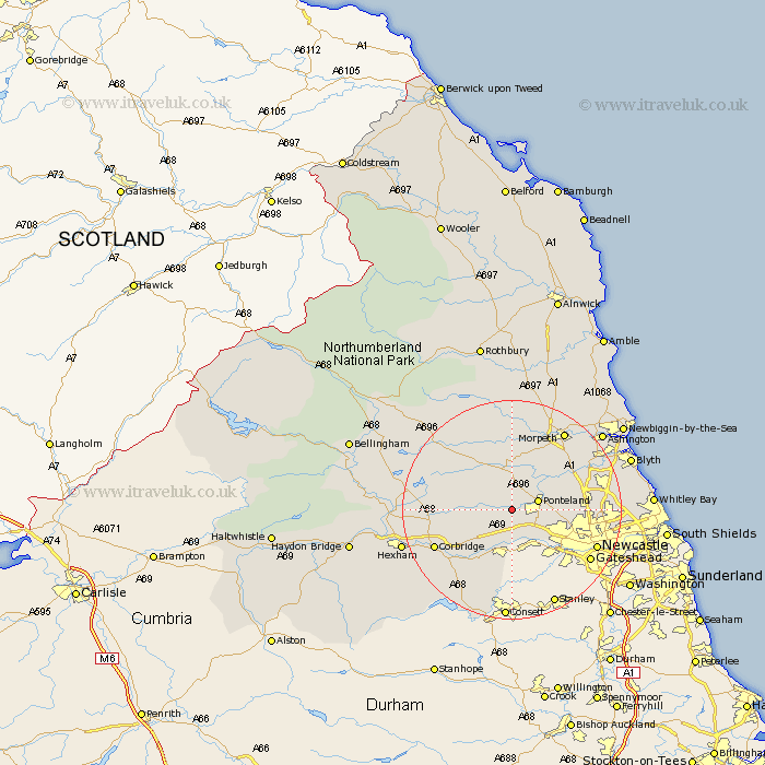
Northumberland Map Showing Location of Dalton
District: Castle Morpeth
Easting: 411716 Northing: 570998
Latitude: 55.03 Longitude: -1.82
 = Dalton
Easting: 411716 Northing: 570998
Latitude: 55.03 Longitude: -1.82
= Dalton
This Dalton map below is supplied by Google. Use the tools in the top left corner to zoom into street level or zoom out for a road map, you may also need to zoom in to see Dalton on the map. Click and drag the map to move around. If the map fails to load try and refresh your browser or zoom in or out (+ or -).
Update - it seems Google no longer allow people to use their maps for free! This Dalton map sometimes loads and sometimes gives a error. I am working on a solution.
Closest 30 Towns or Cities to Dalton (Population over 500)
Stamfordham 3.19km Ponteland 4.64km Wylam 7.71km Ovingham 8.06km Dinnington 8.7km Woolsington 8.7km Newburn 9.12km Prudhoe 9.5km Stannington 12.09km Stocksfield 12.82km Gosforth 13.28km Riding 14.67km Ridingmill 14.67km Corbridge 14.75km Dudley 15.09km Cramlington 15.32km Newcastle on Tyne 15.68km Newcastle 15.68km Newcastle-on-Tyne 15.68km Newcastle upon Tyne 15.68km Sandhoe 15.88km Killingworth 15.93km Shiremoor 16.15km Longbenton 16.36km Long Benton 16.36km Hepscott 16.76km Wallsend-on-Tyne 17.03km Wallsend on Tyne 17.03km Wallsend 17.03km Morpeth 17.09km