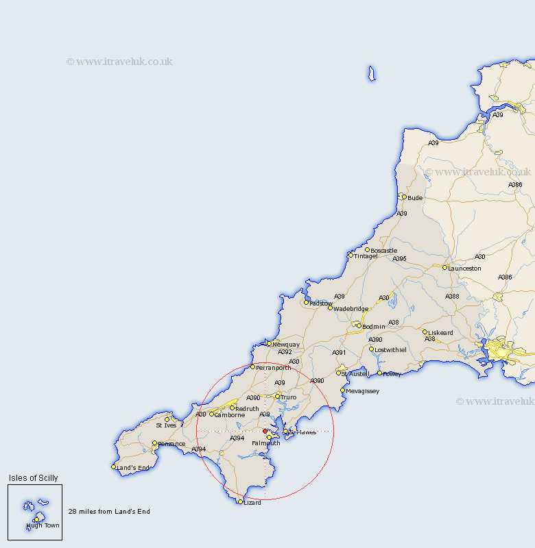
Cornwall Map Showing Location of Penryn
Population: 6846
Area Size (ha): 174
District: Carrick
Easting: 178641 Northing: 34299
Latitude: 50.17 Longitude: -5.1
 = Penryn
Area Size (ha): 174
District: Carrick
Easting: 178641 Northing: 34299
Latitude: 50.17 Longitude: -5.1
= Penryn
This Penryn map below is supplied by Google. Use the tools in the top left corner to zoom into street level or zoom out for a road map, you may also need to zoom in to see Penryn on the map. Click and drag the map to move around. If the map fails to load try and refresh your browser or zoom in or out (+ or -).
Update - it seems Google no longer allow people to use their maps for free! This Penryn map sometimes loads and sometimes gives a error. I am working on a solution.
Closest 30 Towns or Cities to Penryn (Population over 500)
Budock 2.2km Budock Water 2.2km Falmouth 2.21km Mylor 3.56km Mylor Bridge 3.56km St Feoch 5.14km St. Feock 5.14km Saint Feock 5.14km Feock 5.14km St Feock 5.14km St. Feoch 5.14km Saint Feoch 5.14km Stithians 6.21km Gwennap 7.31km Constatine 7.31km Constantine 7.31km Mawnan 7.42km Kea 8.22km Gerrans 8.31km St. Day 9.49km Saint Day 9.49km St Day 9.49km Chacewater 10.41km Gweek 11.14km Wendron 11.31km Kenwyn 11.37km Truro 11.67km Redruth 12.04km Illogan 13.98km Veryan 14.19km