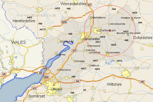
Gloucestershire Map Showing Location of Charlton Abbots
District: Cotswold
Easting: 403439 Northing: 222433
Latitude: 51.9 Longitude: -1.95
 = Charlton Abbots
Easting: 403439 Northing: 222433
Latitude: 51.9 Longitude: -1.95
= Charlton Abbots
This Charlton Abbots map below is supplied by Google. Use the tools in the top left corner to zoom into street level or zoom out for a road map, you may also need to zoom in to see Charlton Abbots on the map. Click and drag the map to move around. If the map fails to load try and refresh your browser or zoom in or out (+ or -).
Update - it seems Google no longer allow people to use their maps for free! This Charlton Abbots map sometimes loads and sometimes gives a error. I am working on a solution.
Closest 30 Towns or Cities to Charlton Abbots (Population over 500)
Andoversford 3.7km Winchcombe 5.56km Winchcomb 5.56km Withington 7.42km Southam 7.79km Charlton Kings 8.82km Cheltenham 9.15km Bishops Cleeve 9.74km Leckhampton 9.87km Alderton 9.88km Swindon 10.93km Chedworth 11.35km Northleach 11.78km Shurdington 12.02km Dumbleton 13.03km Bourton on the Water 14.22km Bourton-on-the-Water 14.22km North Cerney 14.87km Staverton 14.98km Churchdown 14.98km Stow-on-the-Wold 15.32km Stow on the Wold 15.32km Brockworth 15.88km Ashchurch 15.94km Hucclecote 16.96km Innsworth 17.26km Tewkesbury 17.65km Deerhurst 18.68km Cicester 18.68km Cirencester 18.68km