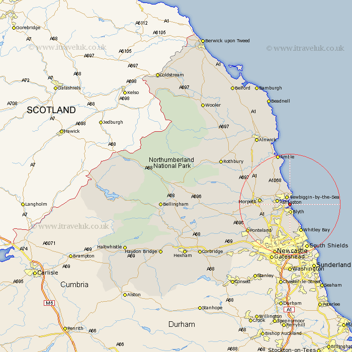
Northumberland Map Showing Location of Cambois
District: Wansbeck
Easting: 430799 Northing: 584074
Latitude: 55.15 Longitude: -1.52
 = Cambois
Easting: 430799 Northing: 584074
Latitude: 55.15 Longitude: -1.52
= Cambois
This Cambois map below is supplied by Google. Use the tools in the top left corner to zoom into street level or zoom out for a road map, you may also need to zoom in to see Cambois on the map. Click and drag the map to move around. If the map fails to load try and refresh your browser or zoom in or out (+ or -).
Update - it seems Google no longer allow people to use their maps for free! This Cambois map sometimes loads and sometimes gives a error. I am working on a solution.
Closest 30 Towns or Cities to Cambois (Population over 500)
Newbiggin-by-the-Sea 3.2km Newbiggin by the Sea 3.2km Blythe 3.27km Blyth 3.27km Ashington 4.69km Bedlington 4.79km Lynemouth 7.21km Seaton Sluice 7.33km Pegswood 7.64km Ellington 8.07km Hepscott 8.47km Seaton Delaval 9.26km Dudley 9.38km Cramlington 10.19km Morpeth 10.75km Stannington 11.04km Hebron 11.21km Seghill 11.32km Whitley Bay 11.73km Whitley 11.73km Shiremoor 13.06km Killingworth 13.36km Tynemouth 15.01km Dinnington 15.36km East Chevington 15.41km North Shields 16.4km Long Benton 16.98km Longbenton 16.98km Wallsend 17.85km Wallsend-on-Tyne 17.85km