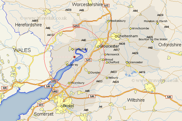
Gloucestershire Map Showing Location of Blakeney
District: Forest of Dean
Easting: 367799 Northing: 207711
Latitude: 51.77 Longitude: -2.47
 = Blakeney
Easting: 367799 Northing: 207711
Latitude: 51.77 Longitude: -2.47
= Blakeney
This Blakeney map below is supplied by Google. Use the tools in the top left corner to zoom into street level or zoom out for a road map, you may also need to zoom in to see Blakeney on the map. Click and drag the map to move around. If the map fails to load try and refresh your browser or zoom in or out (+ or -).
Update - it seems Google no longer allow people to use their maps for free! This Blakeney map sometimes loads and sometimes gives a error. I am working on a solution.
Closest 30 Towns or Cities to Blakeney (Population over 500)
Awre 2.29km Newham 4.36km Newnham 4.36km Cinderford 5.67km Frampton 6.88km Frampton-on-Severn 6.88km Frampton on Severn 6.88km Bream 7.13km Lydney 7.21km Slimbridge 7.99km Berkeley 9.34km Drybrook 9.54km Coleford 9.89km Coaley 10.73km Cam 10.94km Longhope 11.18km Mitcheldean 11.18km Milcheldean 11.18km Woolaston 11.8km Huntley 12.03km Lydbrook 12.25km North Nibley 12.51km Hardwicke 12.74km Newland 12.75km Stonehouse 12.75km Stone 12.98km Staunton 13.78km Quedgeley 13.78km Uley 13.88km Dursley 14.42km