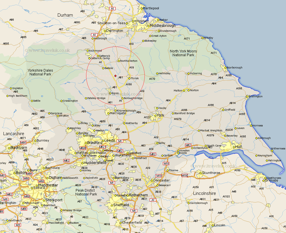
Yorkshire Map Showing Location of Pickhill
District: Hambleton
Easting: 434760 Northing: 482104
Latitude: 54.23 Longitude: -1.47
 = Pickhill
Easting: 434760 Northing: 482104
Latitude: 54.23 Longitude: -1.47
= Pickhill
This Pickhill map below is supplied by Google. Use the tools in the top left corner to zoom into street level or zoom out for a road map, you may also need to zoom in to see Pickhill on the map. Click and drag the map to move around. If the map fails to load try and refresh your browser or zoom in or out (+ or -).
Update - it seems Google no longer allow people to use their maps for free! This Pickhill map sometimes loads and sometimes gives a error. I am working on a solution.
Closest 30 Towns or Cities to Pickhill (Population over 500)
West Tanfield 7.48km Tanfield 7.48km Topcliffe 7.76km Thirsk 8.86km Bedale 9.4km Dishforth 9.82km Northallerton 11.33km Masham 12.06km Crakehall 12.24km Grewelthorpe 13.16km Ripon 13.37km Brompton 13.38km Kirkby Malzeard 14.04km Bishop Monkton 16.82km Monkton 16.82km Boroughbridge 17.23km Raskelf 17.96km Catterick 18.35km Osmotherley 18.36km Burton Leonard 18.65km Scorton 18.79km North Cowton 19.31km Marton 19.64km Marton le Moor 19.64km East Cowton 20.85km Cowton 20.85km Easingwold 21.66km Alne 22.56km Ouseburn 22.6km Great Ouseburn 22.6km