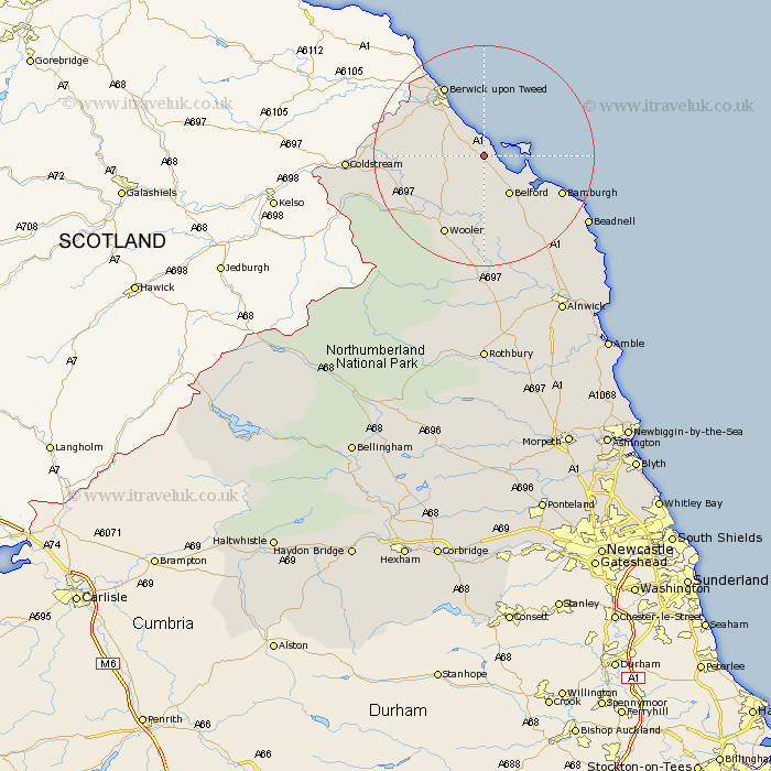
Northumberland Map Showing Location of Beal
District: Berwick-upon-Tweed
Easting: 406289 Northing: 641469
Latitude: 55.67 Longitude: -1.9
 = Beal
Easting: 406289 Northing: 641469
Latitude: 55.67 Longitude: -1.9
= Beal
This Beal map below is supplied by Google. Use the tools in the top left corner to zoom into street level or zoom out for a road map, you may also need to zoom in to see Beal on the map. Click and drag the map to move around. If the map fails to load try and refresh your browser or zoom in or out (+ or -).
Update - it seems Google no longer allow people to use their maps for free! This Beal map sometimes loads and sometimes gives a error. I am working on a solution.
Closest 30 Towns or Cities to Beal (Population over 500)
Lowick 5.59km Ancroft 7.28km Belford 8.52km Ord 11.8km East Ord 11.8km Berwick on Tweed 14.4km Berwick upon Tweed 14.4km Berwick-Upon-Tweed 14.4km Berwick 14.4km Berwick-upon-Tweed 14.4km Berwick-on-Tweed 14.4km Wooler 16.11km Norham 16.63km North Sunderland 18.39km Beadnell 21.19km Embleton 27.08km Alnwick 32.22km Almwick 32.22km Alnmouth 35.16km Shilbottle 36.04km Lesbury 36.21km Lisburg 36.21km Rothbury 38.92km Warkworth 39.48km Amble 42.1km Swarland 42.11km Longframlington 43.26km Felton 44.46km East Thirston 44.77km Thirston 44.77km