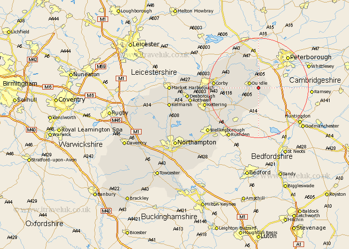
Northamptonshire Map Showing Location of Polebrook
Population: 453
District: East Northamptonshire
Easting: 507548 Northing: 286633
Latitude: 52.47 Longitude: -0.42
 = Polebrook
District: East Northamptonshire
Easting: 507548 Northing: 286633
Latitude: 52.47 Longitude: -0.42
= Polebrook
This Polebrook map below is supplied by Google. Use the tools in the top left corner to zoom into street level or zoom out for a road map, you may also need to zoom in to see Polebrook on the map. Click and drag the map to move around. If the map fails to load try and refresh your browser or zoom in or out (+ or -).
Update - it seems Google no longer allow people to use their maps for free! This Polebrook map sometimes loads and sometimes gives a error. I am working on a solution.
Closest 30 Towns or Cities to Polebrook (Population over 500)
Oundle 3.86km Warmington 3.87km Titchmarsh 8.68km Nassington 9.27km Thrapston 10.84km Islip 12.19km Kings Cliffe 12.47km King's Cliffe 12.47km Brigstock 12.56km Weldon 14.79km Woodford 15.07km Stanion 15.81km Ringstead 15.81km Raunds 16.81km Corby 17.03km Geddington 18.45km Gretton 18.47km Stanwick 18.97km Irthlingborough 20.8km Finedon 20.88km Caldecott 21.06km Burton Latimer 21.35km Kettering 21.65km Higham Ferrers 21.71km Cottingham 22.65km Isham 23.19km Rushden 23.32km Wilbarston 26.03km Broughton 26.21km Rothwell 26.57km