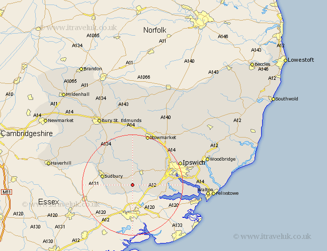
Suffolk Map Showing Location of Polstead
Population: 808
District: Babergh
Easting: 599046 Northing: 237524
Latitude: 52 Longitude: 0.9
 = Polstead
District: Babergh
Easting: 599046 Northing: 237524
Latitude: 52 Longitude: 0.9
= Polstead
This Polstead map below is supplied by Google. Use the tools in the top left corner to zoom into street level or zoom out for a road map, you may also need to zoom in to see Polstead on the map. Click and drag the map to move around. If the map fails to load try and refresh your browser or zoom in or out (+ or -).
Update - it seems Google no longer allow people to use their maps for free! This Polstead map sometimes loads and sometimes gives a error. I am working on a solution.
Closest 30 Towns or Cities to Polstead (Population over 500)
Boxford 2.94km Layham 4.93km Hadleigh 6.53km East Bergholt 8.81km Great Cornard 9.85km Waldingfield 10.9km Great Waldingfield 10.9km Bildeston 11.18km Capel 11.41km Capel St. Mary 11.41km Capel Saint Mary 11.41km Capel St Mary 11.41km Hintlesham 11.67km Sudbury 11.99km Bentley 12.69km Manningtree 12.7km Hitcham 12.98km Lavenham 13.05km Great Bricett 14.17km Long Melford 14.57km Sproughton 14.77km Sprughton 14.77km Somersham 15.13km Bramford 15.56km Ringshall 15.88km Claydon 17.48km Stutton 17.52km Great Blakenham 17.63km Holbrook 18.35km Cockfield 18.49km