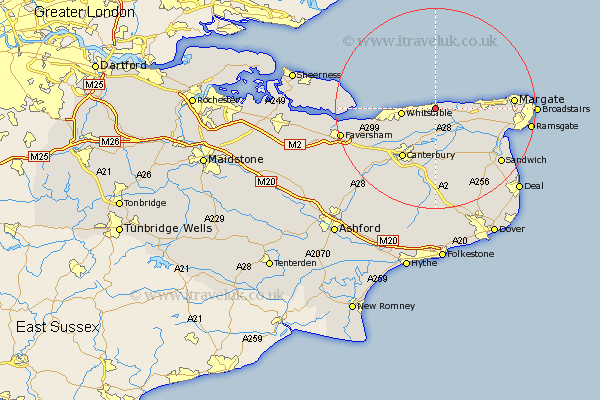
Kent Map Showing Location of Beltinge
District: Canterbury
Easting: 620298 Northing: 168037
Latitude: 51.37 Longitude: 1.17
 = Beltinge
Easting: 620298 Northing: 168037
Latitude: 51.37 Longitude: 1.17
= Beltinge
This Beltinge map below is supplied by Google. Use the tools in the top left corner to zoom into street level or zoom out for a road map, you may also need to zoom in to see Beltinge on the map. Click and drag the map to move around. If the map fails to load try and refresh your browser or zoom in or out (+ or -).
Update - it seems Google no longer allow people to use their maps for free! This Beltinge map sometimes loads and sometimes gives a error. I am working on a solution.
Closest 30 Towns or Cities to Beltinge (Population over 500)
Broomfield 2.14km Herne Bay 2.22km Hoath 3.87km Chislet 4.56km St Nicholas at Wade 6.22km St. Nicholas at Wade 6.22km Saint Nicholas at Wade 6.22km Whitstable 6.7km Chestfield 7.14km Preston 8.93km Monkton 9.07km Birchington 9.35km Sturry 10.02km Hackington 11.02km Blean 11.02km Littlebourne 11.28km Wingham 11.83km Minster 11.97km Canterbury 12km Harbledown 13.15km Manston 14.13km Staple 14.39km Bridge 15.37km Margate 15.46km Dunkirk 15.77km Lower Hardres 16.48km Chartham 16.71km Sandwich 17.09km St. Peters 17.45km Saint Peters 17.45km