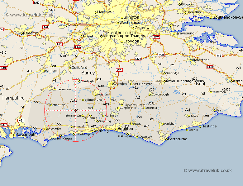
Sussex Map Showing Location of Pulborough
Population: 3395
Area Size (ha): 167
District: Horsham
Easting: 504184 Northing: 117837
Latitude: 50.95 Longitude: -0.52
 = Pulborough
Area Size (ha): 167
District: Horsham
Easting: 504184 Northing: 117837
Latitude: 50.95 Longitude: -0.52
= Pulborough
This Pulborough map below is supplied by Google. Use the tools in the top left corner to zoom into street level or zoom out for a road map, you may also need to zoom in to see Pulborough on the map. Click and drag the map to move around. If the map fails to load try and refresh your browser or zoom in or out (+ or -).
Update - it seems Google no longer allow people to use their maps for free! This Pulborough map sometimes loads and sometimes gives a error. I am working on a solution.
Closest 30 Towns or Cities to Pulborough (Population over 500)
Coldwaltham 2.19km Fittleworth 3.5km Amberley 3.88km West Chillington 5.03km West Chiltington 5.03km Storrington 5.87km Bury 6.57km Petworth 6.91km Thakeham 7.25km Wisborough Green 7.51km Kirdford 7.78km Tillington 7.92km Billingshurst 8.76km Washington 9.89km Ashington 10.05km Shipley 10.67km Arundel 11.36km Plaistow 11.66km Graffham 11.82km Lurgashall 12.86km West Grinstead 12.97km Loxwood 12.98km Walberton 13.15km Itchingfield 13.15km Slinfold 13.79km North Chapel 13.8km Northchapel 13.8km Findon 13.81km Slindon 13.81km Southwater 13.82km