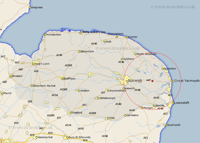
Norfolk Map Showing Location of Acle
Population: 2221
Area Size (ha): 74
District: Broadland
Easting: 640191 Northing: 309909
Latitude: 52.63 Longitude: 1.55
 = Acle
Area Size (ha): 74
District: Broadland
Easting: 640191 Northing: 309909
Latitude: 52.63 Longitude: 1.55
= Acle
This Acle map below is supplied by Google. Use the tools in the top left corner to zoom into street level or zoom out for a road map, you may also need to zoom in to see Acle on the map. Click and drag the map to move around. If the map fails to load try and refresh your browser or zoom in or out (+ or -).
Update - it seems Google no longer allow people to use their maps for free! This Acle map sometimes loads and sometimes gives a error. I am working on a solution.
Closest 30 Towns or Cities to Acle (Population over 500)
Upton 1.85km South Walsham 2.17km Lingwood 4.87km Freethorpe 5.56km Blofield 7km Ludham 7.5km Cantley 7.74km Filby 8.09km Brundall 8.09km Horning 8.14km Martham 8.67km Potter Heigham 9.33km Reedham 9.33km Rollesby 9.63km Great Plumstead 10.29km Salhouse 10.57km Ormesby St. Margaret 10.78km Ormesby St Margaret 10.78km Great Ormesby 10.78km Ormesby Saint Margaret 10.78km Catfield 11.17km Thurlton 11.18km Hemsby 11.54km Chedgrave 11.62km Belton 11.66km Thurton 12.16km Hoveton 12.38km Neatishead 12.45km Fritton 12.47km Wroxham 12.54km