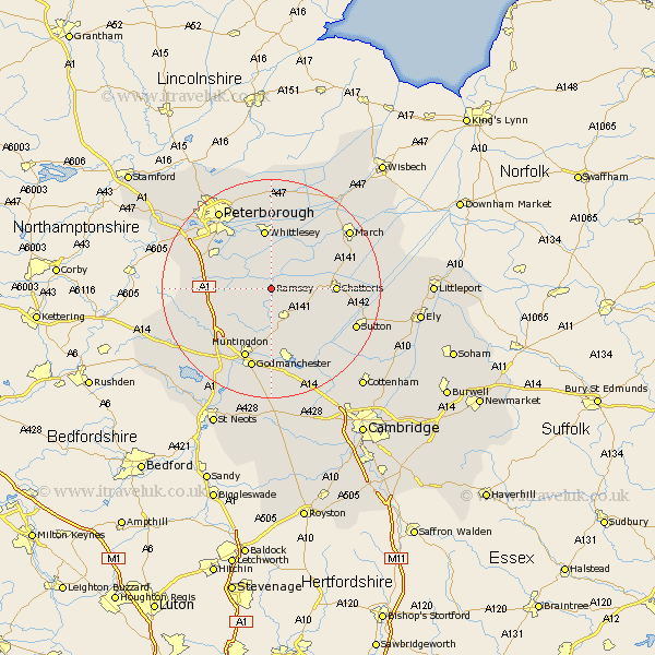
Cambridgeshire Map Showing Location of Ramsey
Population: 7433
Area Size (ha): 632
District: Huntingdonshire
Easting: 527973 Northing: 285269
Latitude: 52.45 Longitude: -0.12
 = Ramsey
Area Size (ha): 632
District: Huntingdonshire
Easting: 527973 Northing: 285269
Latitude: 52.45 Longitude: -0.12
= Ramsey
This Ramsey map below is supplied by Google. Use the tools in the top left corner to zoom into street level or zoom out for a road map, you may also need to zoom in to see Ramsey on the map. Click and drag the map to move around. If the map fails to load try and refresh your browser or zoom in or out (+ or -).
Update - it seems Google no longer allow people to use their maps for free! This Ramsey map sometimes loads and sometimes gives a error. I am working on a solution.
Closest 30 Towns or Cities to Ramsey (Population over 500)
Bury 3.87km Wistow 5.67km Warboys 6.51km Holme 8.12km Sawtry 10.34km Yaxley 10.6km Somersham 10.84km Whittlesey 11.18km Chatteris 11.29km Stilton 11.88km Farcet 12.17km Colne 12.95km Doddington 12.96km Folksworth 12.96km Wyton 12.98km Wimblington 13.61km Huntingdon 13.74km Alconbury 13.76km Earith 14.33km Bluntisham 14.33km Hemingford Grey 14.82km Hemingford 14.82km West Hemingford 14.87km Hemingford Abbots 14.87km Godmanchester 15.21km Durolipons 15.21km Needingworth 16.3km Sutton 16.46km Orton Waterville 16.66km Mepal 16.77km