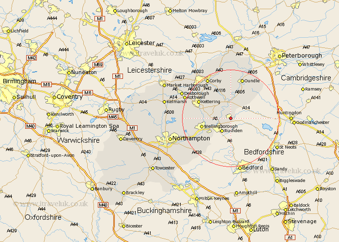
Northamptonshire Map Showing Location of Raunds
Population: 7283
Area Size (ha): 183
District: East Northamptonshire
Easting: 499925 Northing: 271634
Latitude: 52.33 Longitude: -0.53
 = Raunds
Area Size (ha): 183
District: East Northamptonshire
Easting: 499925 Northing: 271634
Latitude: 52.33 Longitude: -0.53
= Raunds
This Raunds map below is supplied by Google. Use the tools in the top left corner to zoom into street level or zoom out for a road map, you may also need to zoom in to see Raunds on the map. Click and drag the map to move around. If the map fails to load try and refresh your browser or zoom in or out (+ or -).
Update - it seems Google no longer allow people to use their maps for free! This Raunds map sometimes loads and sometimes gives a error. I am working on a solution.
Closest 30 Towns or Cities to Raunds (Population over 500)
Stanwick 2.17km Ringstead 2.17km Woodford 4.35km Irthlingborough 4.89km Higham Ferrers 5.03km Islip 5.56km Rushden 6.52km Finedon 6.79km Thrapston 7.42km Titchmarsh 8.16km Burton Latimer 9.25km Irchester 10.05km Isham 11.47km Wellingborough 11.92km Wollaston 12.96km Great Doddington 13.54km Doddington 13.54km Brigstock 13.74km Kettering 14.49km Wilby 14.5km Geddington 15.08km Bozeat 15.82km Broughton 16.28km Stanion 16.81km Oundle 17.28km Earls Barton 17.4km Sywell 17.88km Weldon 18.01km Whiston 18.46km Corby 18.97km