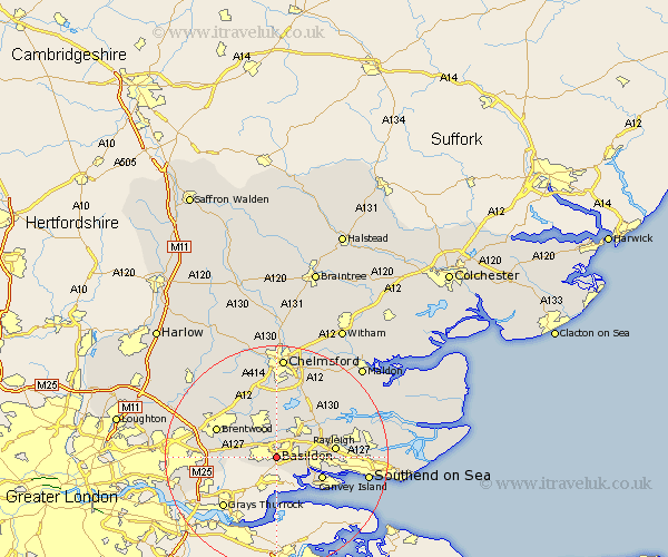
Essex Map Showing Location of Basildon
Population: 99078
Area Size (ha): 2358
District: Basildon
Easting: 570939 Northing: 188249
Latitude: 51.57 Longitude: 0.47
 = Basildon
Area Size (ha): 2358
District: Basildon
Easting: 570939 Northing: 188249
Latitude: 51.57 Longitude: 0.47
= Basildon
This Basildon map below is supplied by Google. Use the tools in the top left corner to zoom into street level or zoom out for a road map, you may also need to zoom in to see Basildon on the map. Click and drag the map to move around. If the map fails to load try and refresh your browser or zoom in or out (+ or -).
Update - it seems Google no longer allow people to use their maps for free! This Basildon map sometimes loads and sometimes gives a error. I am working on a solution.
Closest 30 Towns or Cities to Basildon (Population over 500)
Great Burstead 3.92km Wickford 5.06km Corringham 5.33km Ramsden Heath 5.67km Billericay 6.55km Benfleet 6.86km South Benfleet 6.86km Rawreth 7.84km South Hanningfield 8.17km Stanford le Hope 8.18km Canvey Island 8.88km Herongate 9.08km Ingrave 9.4km West Hanningfield 9.54km Stock 9.54km Rayleigh 10.53km Rettendon 10.91km Mountnessing 10.94km Brentwood 11.76km Ingatestone 12.52km East Hanningfield 12.52km Hockley 12.8km Woodham Ferrers 13.06km Grays 13.08km Grays Thurrock 13.08km Margaretting 13.42km South Ockedon 13.71km South Ockendon 13.71km Hawkwell 13.94km Leigh 13.95km