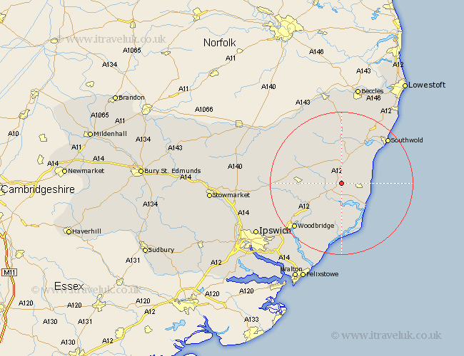
Suffolk Map Showing Location of Saxmundham
Population: 2465
Area Size (ha): 78
District: Suffolk Coastal
Easting: 639054 Northing: 263427
Latitude: 52.22 Longitude: 1.5
 = Saxmundham
Area Size (ha): 78
District: Suffolk Coastal
Easting: 639054 Northing: 263427
Latitude: 52.22 Longitude: 1.5
= Saxmundham
This Saxmundham map below is supplied by Google. Use the tools in the top left corner to zoom into street level or zoom out for a road map, you may also need to zoom in to see Saxmundham on the map. Click and drag the map to move around. If the map fails to load try and refresh your browser or zoom in or out (+ or -).
Update - it seems Google no longer allow people to use their maps for free! This Saxmundham map sometimes loads and sometimes gives a error. I am working on a solution.
Closest 30 Towns or Cities to Saxmundham (Population over 500)
Snape 3.71km Leiston 4.91km Yoxford 5.67km Thorpe 9.7km Thorpeness 9.7km Tunstall 9.88km Aldeburgh 10.07km Framlingham 11.35km Cookley 11.63km Wenhaston 11.63km Wickham Market 11.73km Rendlesham 12.49km Laxfield 12.97km Holton 13.02km Dennington 14.71km Halesworth 14.82km Orford 15.01km Ufford 15.11km Wangford 16.81km Worlingworth 17.91km Southwold 17.99km Woodbridge 18.02km Melton 18.02km Reydon 18.66km Hollesley 19.09km Stradbroke 19.38km Sutton 19.57km Otley 19.64km Fressingfield 20.12km Martlesham 20.15km