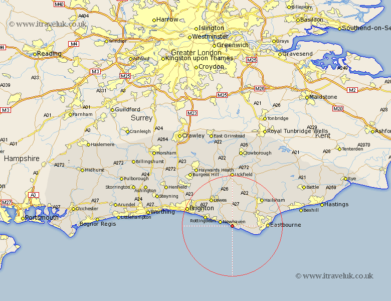
Sussex Map Showing Location of Seaford
Population: 19508
Area Size (ha): 598
District: Lewes
Easting: 548073 Northing: 98511
Latitude: 50.77 Longitude: 0.1
 = Seaford
Area Size (ha): 598
District: Lewes
Easting: 548073 Northing: 98511
Latitude: 50.77 Longitude: 0.1
= Seaford
This Seaford map below is supplied by Google. Use the tools in the top left corner to zoom into street level or zoom out for a road map, you may also need to zoom in to see Seaford on the map. Click and drag the map to move around. If the map fails to load try and refresh your browser or zoom in or out (+ or -).
Update - it seems Google no longer allow people to use their maps for free! This Seaford map sometimes loads and sometimes gives a error. I am working on a solution.
Closest 30 Towns or Cities to Seaford (Population over 500)
Newhaven 5.04km Alfriston 5.11km Friston 7.27km Jevington 8.41km Chalvington 9.91km Polegate 10.08km Rottingdean 11.18km Saltdean 11.58km Kingston 12.37km Kingston near Lewes 12.37km Laughton 13.17km Ringmer 13.18km Lewes 13.81km Eastbourne 14.07km Hellingly 15.32km Barcombe Mills Station 15.54km Chiddingly 15.94km Hailsham 16.15km Plumpton 16.71km East Hoathly 17.32km Pevensey 17.96km Isfield 18.67km Brighton 19.07km Pevensey Bay 19.11km Horam 19.73km Horeham 19.73km Framfield 20.52km Hurstmonceaux 20.9km Herstmonceux 20.9km Hurstmonceux 20.9km