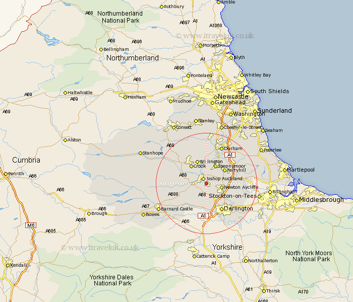
Durham Map Showing Location of Shildon
Population: 11020
Area Size (ha): 246
District: Sedgefield
Easting: 422590 Northing: 526532
Latitude: 54.63 Longitude: -1.65
 = Shildon
Area Size (ha): 246
District: Sedgefield
Easting: 422590 Northing: 526532
Latitude: 54.63 Longitude: -1.65
= Shildon
This Shildon map below is supplied by Google. Use the tools in the top left corner to zoom into street level or zoom out for a road map, you may also need to zoom in to see Shildon on the map. Click and drag the map to move around. If the map fails to load try and refresh your browser or zoom in or out (+ or -).
Update - it seems Google no longer allow people to use their maps for free! This Shildon map sometimes loads and sometimes gives a error. I am working on a solution.
Closest 30 Towns or Cities to Shildon (Population over 500)
Shildon 0km Bishop Auckland 2.14km Coundon 3.71km West Auckland 5.36km Newton Aycliffe 5.67km Etherley 6.7km High Etherley 6.7km Evenwood 7.73km Spennymoor 8.01km Ferryhill 8.5km Crook 9.15km Willington 9.82km Cockfield 9.83km Gainford 10.71km West Cornforth 11.34km Cornforth 11.34km Bishop Middleham 12.08km Staindrop 12.17km Darlington 12.35km Brandon 13.15km Coxhoe 13.38km Bowburn 14.04km Sedgefield 14.06km Stillington 14.43km Fishburn 15km Tow Law 15.44km Durham 15.77km Shincliffe 16.62km Ushaw Moor 16.68km Trimdon 16.74km