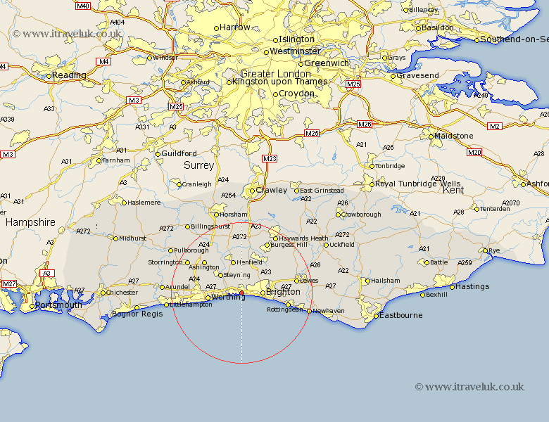
Sussex Map Showing Location of Shoreham By Sea
Population: 17306
Area Size (ha): 435
District: Adur
Easting: 524393 Northing: 105305
Latitude: 50.83 Longitude: -0.23
 = Shoreham By Sea
Area Size (ha): 435
District: Adur
Easting: 524393 Northing: 105305
Latitude: 50.83 Longitude: -0.23
= Shoreham By Sea
This Shoreham By Sea map below is supplied by Google. Use the tools in the top left corner to zoom into street level or zoom out for a road map, you may also need to zoom in to see Shoreham By Sea on the map. Click and drag the map to move around. If the map fails to load try and refresh your browser or zoom in or out (+ or -).
Update - it seems Google no longer allow people to use their maps for free! This Shoreham By Sea map sometimes loads and sometimes gives a error. I am working on a solution.
Closest 30 Towns or Cities to Shoreham By Sea (Population over 500)
Southwick 1.17km Portslade 1.17km Hove 3.51km Brighton 5.85km Lancing 7.26km North Lancing 7.26km Upper Beeding 8.07km Bramber 8.07km Upper Bleeding 8.07km Steyning 8.07km Sompting 8.4km Worthing 9.48km Henfield 9.56km Hurstpierpoint 10.38km Keymer 11.62km Hassocks 11.63km Albourne 11.66km Findon 11.85km Saltdean 13km Ditchelling 13.17km Ditchling 13.17km Rottingdean 13.4km Washington 13.85km Plumpton 14.02km Ashington 14.03km Kingston near Lewes 15.33km Kingston 15.33km Lewes 15.66km Ferring 15.67km West Ferring 15.67km