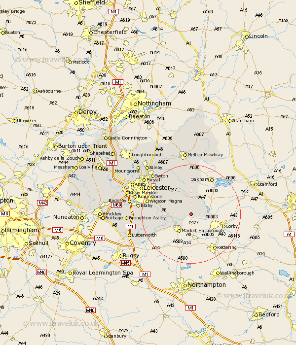
Leicestershire Map Showing Location of Slawston
Population: 143
District: Harborough
Easting: 477997 Northing: 293487
Latitude: 52.53 Longitude: -0.85
 = Slawston
District: Harborough
Easting: 477997 Northing: 293487
Latitude: 52.53 Longitude: -0.85
= Slawston
This Slawston map below is supplied by Google. Use the tools in the top left corner to zoom into street level or zoom out for a road map, you may also need to zoom in to see Slawston on the map. Click and drag the map to move around. If the map fails to load try and refresh your browser or zoom in or out (+ or -).
Update - it seems Google no longer allow people to use their maps for free! This Slawston map sometimes loads and sometimes gives a error. I am working on a solution.
Closest 30 Towns or Cities to Slawston (Population over 500)
Hallaton 2.17km Bowden 6.51km Great Bowden 6.51km Great Easton 7.01km Market Harborough 8.67km Kibworth 9.02km Kibworth Harcourt 9.02km Billesdon 9.31km Lubenham 10.03km Houghton-on-the-Hill 12.93km Houghton on the Hill 12.93km Houghton 12.93km Great Glen 12.94km Somerby 14.88km Twyford 15.5km Husbands Bosworth 16.41km Oadby 16.72km Wigston 17.79km Wigston Magna 17.79km Glen Parva 18.41km Glen Parka 18.41km Countesthorpe 19.25km Walton 19.51km Walton-in-Knaptoft 19.51km Gaddesby 20.14km Blaby 20.62km Queniborough 20.77km Queniboro 20.77km Gilmorton 21.61km Gilmarton 21.61km