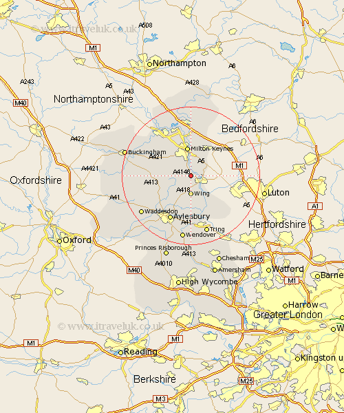
Buckinghamshire Map Showing Location of Soulbury
Population: 719
District: Aylesbury Vale
Easting: 488222 Northing: 226917
Latitude: 51.93 Longitude: -0.72
 = Soulbury
District: Aylesbury Vale
Easting: 488222 Northing: 226917
Latitude: 51.93 Longitude: -0.72
= Soulbury
This Soulbury map below is supplied by Google. Use the tools in the top left corner to zoom into street level or zoom out for a road map, you may also need to zoom in to see Soulbury on the map. Click and drag the map to move around. If the map fails to load try and refresh your browser or zoom in or out (+ or -).
Update - it seems Google no longer allow people to use their maps for free! This Soulbury map sometimes loads and sometimes gives a error. I am working on a solution.
Closest 30 Towns or Cities to Soulbury (Population over 500)
Stoke Hammond 1.85km Stewkley 2.94km Great Brickhill 2.94km Newton Longville 5.05km Wing 5.56km Bletchley 5.67km Bow Brickhill 6.53km Mursley 6.86km Shenley Brook End 8.17km Milton Keynes 8.61km Simpson 9.34km Woburn Sands 9.36km Slapton 9.36km Whitechurch 9.75km Whitchurch 9.75km Wavendon 9.88km Shenley Church End 10.33km Shenley 10.33km Winslow 10.45km Great Horwood 10.93km Cheddington 11.64km North Marston 11.7km Bradwell 12.02km Edlesborough 13.02km Ivinghoe 13.07km Marsworth 13.42km Aylesbury 14.17km Wolverton 14.67km Pitstone 14.67km Thornborough 14.79km