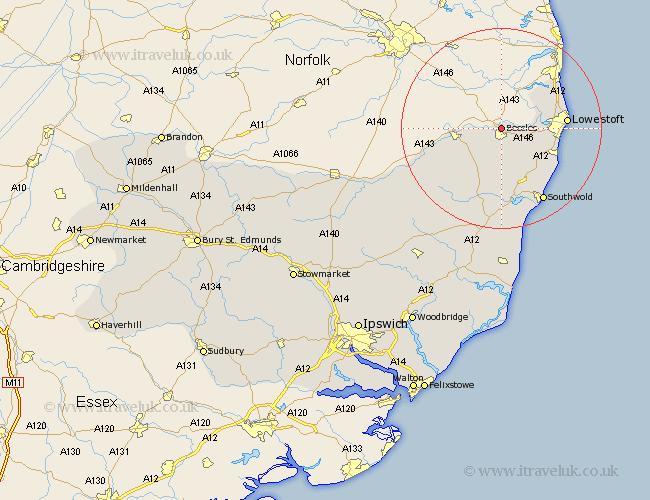
Suffolk Map Showing Location of Beccles
Population: 10136
Area Size (ha): 319
District: Waveney
Easting: 642235 Northing: 291441
Latitude: 52.47 Longitude: 1.57
 = Beccles
Area Size (ha): 319
District: Waveney
Easting: 642235 Northing: 291441
Latitude: 52.47 Longitude: 1.57
= Beccles
This Beccles map below is supplied by Google. Use the tools in the top left corner to zoom into street level or zoom out for a road map, you may also need to zoom in to see Beccles on the map. Click and drag the map to move around. If the map fails to load try and refresh your browser or zoom in or out (+ or -).
Update - it seems Google no longer allow people to use their maps for free! This Beccles map sometimes loads and sometimes gives a error. I am working on a solution.
Closest 30 Towns or Cities to Beccles (Population over 500)
Worlingham 2.17km Bungay 8.12km Carlton Colville 9.22km Gisleham 10.82km Oulton 11.44km Kessingland 11.59km Wrentham 12.19km Lowestoft 12.55km Wangford 13.41km Halesworth 13.74km Corton 14.64km Reydon 14.64km Holton 15.21km Wenhaston 16.72km Southwold 16.81km Cookley 18.46km Fressingfield 22.26km Yoxford 22.5km Laxfield 22.97km Stradbroke 26.32km Hoxne 28.05km Saxmundham 28.17km Dennington 28.68km Leiston 29.66km Worlingworth 30.93km Snape 31.84km Framlingham 32km Eye 32.83km Thorpeness 33.53km Thorpe 33.53km