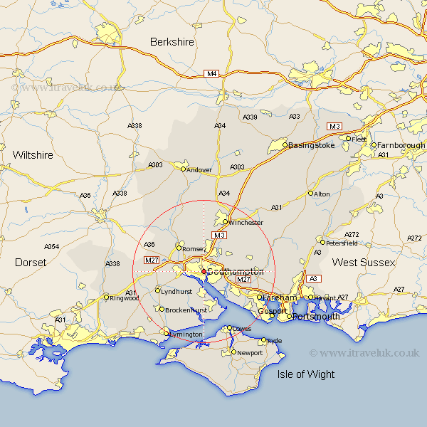
Hampshire Map Showing Location of Southampton
Population: 208784
Area Size (ha): 5166
Easting: 442187 Northing: 111402
Latitude: 50.92 Longitude: -1.4
 = Southampton
Area Size (ha): 5166
Easting: 442187 Northing: 111402
Latitude: 50.92 Longitude: -1.4
= Southampton
This Southampton map below is supplied by Google. Use the tools in the top left corner to zoom into street level or zoom out for a road map, you may also need to zoom in to see Southampton on the map. Click and drag the map to move around. If the map fails to load try and refresh your browser or zoom in or out (+ or -).
Update - it seems Google no longer allow people to use their maps for free! This Southampton map sometimes loads and sometimes gives a error. I am working on a solution.
Closest 30 Towns or Cities to Southampton (Population over 500)
Itchen 2.51km Chilworth 3.53km West End 4.69km Marchwood 4.7km Totton 5.85km Hythe 5.93km Eling 6.25km Eastleigh 6.26km Dibden 6.37km Bishopstoke 6.98km Ashurst 7.41km Netley Marsh 7.55km Netley 7.55km Bursledon 9.18km Botley 9.35km Locks Heath 9.5km Otterbourne 9.56km Hample 9.73km Hamble 9.73km Romsey 9.93km Curdridge 10.52km Curbridge 10.52km Hursley 10.75km Durley 11.03km Compton 11.72km Bewley 12.01km Beaulieu 12.01km Fawley 12.01km Twyford 12.23km Upham 12.78km