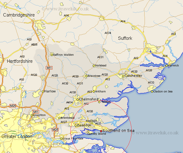
Essex Map Showing Location of Southend
Population: 154102
Area Size (ha): 3514
Easting: 587244 Northing: 185108
Latitude: 51.53 Longitude: 0.7
 = Southend
Area Size (ha): 3514
Easting: 587244 Northing: 185108
Latitude: 51.53 Longitude: 0.7
= Southend
This Southend map below is supplied by Google. Use the tools in the top left corner to zoom into street level or zoom out for a road map, you may also need to zoom in to see Southend on the map. Click and drag the map to move around. If the map fails to load try and refresh your browser or zoom in or out (+ or -).
Update - it seems Google no longer allow people to use their maps for free! This Southend map sometimes loads and sometimes gives a error. I am working on a solution.
Closest 30 Towns or Cities to Southend (Population over 500)
Southend 0km Southend on Sea 0km Southend-on-Sea 0km Leigh 2.96km Leigh-on-Sea 2.96km Leigh on Sea 2.96km Rochford 5.68km Hawkwell 6.02km Little Wakering 6.05km Hockley 6.55km Barling 6.85km Great Wakering 6.92km Rayleigh 8.01km Canvey Island 8.07km Canewdon 8.18km Canewelon 8.18km Benfleet 10.38km South Benfleet 10.38km North Fambridge 11.18km Fambridge 11.18km Rawreth 11.83km Burnham on Crouch 13.07km Burnham-on-Crouch 13.07km Burnham 13.07km Althorne 13.43km Mayland 14.2km Wickford 14.68km Woodham Ferrers 14.7km Snoreham 15.01km Latchingdon and Snoreham 15.01km