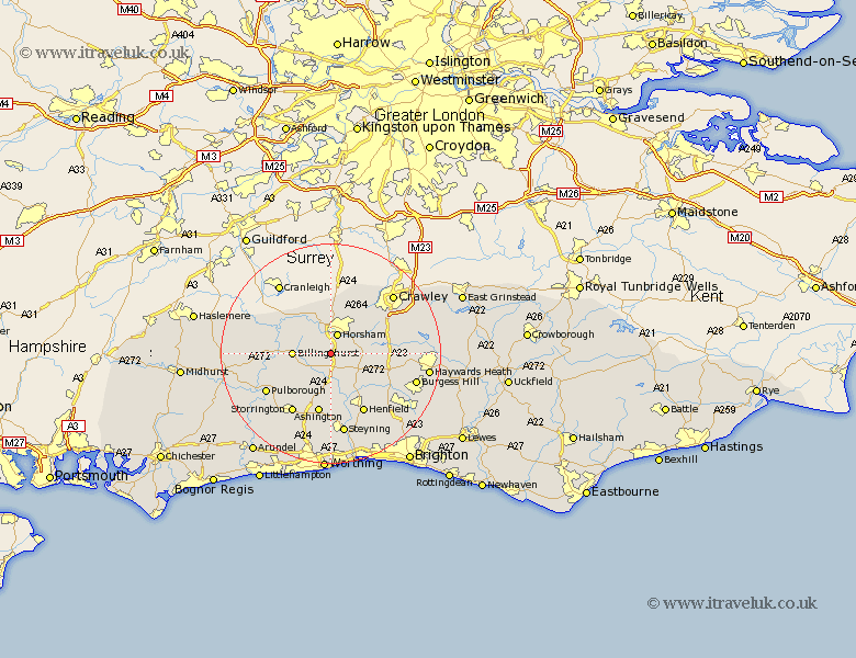
Sussex Map Showing Location of Southwater
Population: 5375
Area Size (ha): 143
District: Horsham
Easting: 515723 Northing: 125502
Latitude: 51.02 Longitude: -0.35
 = Southwater
Area Size (ha): 143
District: Horsham
Easting: 515723 Northing: 125502
Latitude: 51.02 Longitude: -0.35
= Southwater
This Southwater map below is supplied by Google. Use the tools in the top left corner to zoom into street level or zoom out for a road map, you may also need to zoom in to see Southwater on the map. Click and drag the map to move around. If the map fails to load try and refresh your browser or zoom in or out (+ or -).
Update - it seems Google no longer allow people to use their maps for free! This Southwater map sometimes loads and sometimes gives a error. I am working on a solution.
Closest 30 Towns or Cities to Southwater (Population over 500)
Itchingfield 2.97km West Horsham 3.88km Horsham 3.88km Nuthurst 3.96km Slinfold 5.09km Shipley 5.68km West Grinstead 5.68km Cowfold 6.91km Billingshurst 6.99km Lower Beeding 7km Warnham 7.5km Thakeham 10.38km Wisborough Green 10.49km Slaugham 10.65km Rudgwick 10.94km Rusper 10.94km Botney 11.13km Bolney 11.13km Ashington 11.36km West Chiltington 11.62km West Chillington 11.62km Henfield 12.56km Loxwood 12.91km Storrington 13.02km Washington 13.44km Pulborough 13.82km Kirdford 13.99km Albourne 14.9km Steyning 15.01km Upper Bleeding 15.02km