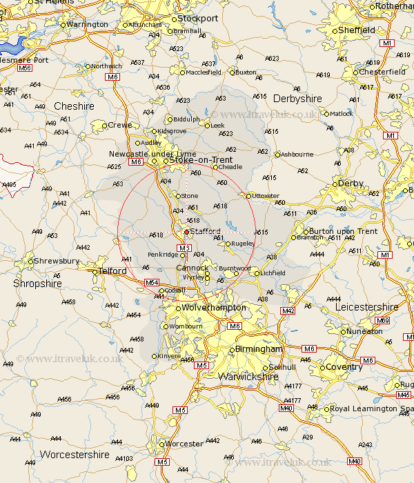
Staffordshire Map Showing Location of Stafford
Population: 63162
Area Size (ha): 1870
District: Stafford
Easting: 393258 Northing: 322534
Latitude: 52.8 Longitude: -2.1
 = Stafford
Area Size (ha): 1870
District: Stafford
Easting: 393258 Northing: 322534
Latitude: 52.8 Longitude: -2.1
= Stafford
This Stafford map below is supplied by Google. Use the tools in the top left corner to zoom into street level or zoom out for a road map, you may also need to zoom in to see Stafford on the map. Click and drag the map to move around. If the map fails to load try and refresh your browser or zoom in or out (+ or -).
Update - it seems Google no longer allow people to use their maps for free! This Stafford map sometimes loads and sometimes gives a error. I am working on a solution.
Closest 30 Towns or Cities to Stafford (Population over 500)
Hopton 3.7km Bednall 4.33km Seighford 5.9km Weston 6.72km Weston upon Trent 6.72km Haughton 6.98km Penkridge 7.5km Colwich 8.06km Gnossall 10.26km Gnosall 10.26km Church Eaton 10.55km Stone 11.34km Eccleshall 11.51km Rugeley 11.8km Huntington 11.99km Wheaton Aston 12.14km Colton 12.87km Hednesford 13km Hilderstone 13.03km Brewood 13.73km Cannock 14.14km Abbots Bromley 14.68km Shareshill 14.86km Swinnerton 15.16km Swynnerton 15.16km Blymhill 15.43km Wyrley 15.57km Great Wyrley 15.57km Church Leigh 15.76km Leigh 15.76km