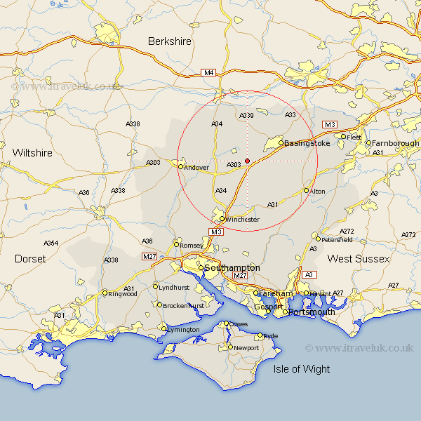
Hampshire Map Showing Location of Steventon
Population: 219
District: Basingstoke and Deane
Easting: 454704 Northing: 146734
Latitude: 51.22 Longitude: -1.22
 = Steventon
District: Basingstoke and Deane
Easting: 454704 Northing: 146734
Latitude: 51.22 Longitude: -1.22
= Steventon
This Steventon map below is supplied by Google. Use the tools in the top left corner to zoom into street level or zoom out for a road map, you may also need to zoom in to see Steventon on the map. Click and drag the map to move around. If the map fails to load try and refresh your browser or zoom in or out (+ or -).
Update - it seems Google no longer allow people to use their maps for free! This Steventon map sometimes loads and sometimes gives a error. I am working on a solution.
Closest 30 Towns or Cities to Steventon (Population over 500)
Overton 2.97km North Waltham 2.97km Oakley 4.37km Dummer 5km Whitchurch 8.13km Micheldever 9.9km Wonston 10.18km Basingstoke 10.82km Kingsclere 11.36km Barton Stacey 11.84km Burghclere 13.12km Longparish 13.3km Baughurst 13.43km Ecchinswell 13.43km Basing 13.92km Upton Grey 15.09km New Alresford 15.23km Bramley 15.25km Medstead 15.26km Highclere 15.3km Tadley 15.92km Kings Worthy 15.93km Four Marks 16.08km Sherfield upon Loddon 16.72km Sherfield 16.72km Chilbolton 16.82km Hurstbourne Tarrant 17.17km Silchester 18.13km Andover 18.67km Alton 18.72km