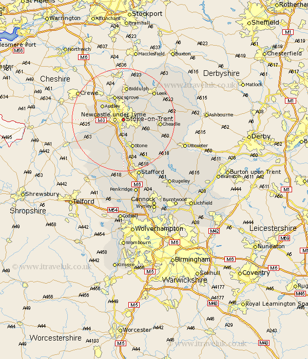
Staffordshire Map Showing Location of Stoke On Trent
Population: 265778
Area Size (ha): 701
Easting: 387697 Northing: 344792
Latitude: 53 Longitude: -2.18
 = Stoke On Trent
Area Size (ha): 701
Easting: 387697 Northing: 344792
Latitude: 53 Longitude: -2.18
= Stoke On Trent
This Stoke On Trent map below is supplied by Google. Use the tools in the top left corner to zoom into street level or zoom out for a road map, you may also need to zoom in to see Stoke On Trent on the map. Click and drag the map to move around. If the map fails to load try and refresh your browser or zoom in or out (+ or -).
Update - it seems Google no longer allow people to use their maps for free! This Stoke On Trent map sometimes loads and sometimes gives a error. I am working on a solution.
Closest 30 Towns or Cities to Stoke On Trent (Population over 500)
Newcastle under Lyme 3.35km Newcastle-under-Lyme 3.35km Barlaston 5.67km Keele 6.69km Silverdale 6.94km Whitmore 7.65km Caverswall 8.03km Swinnerton 9.53km Swynnerton 9.53km Audley 9.58km Fulford 9.59km Kidsgrove 9.85km Madeley 10.04km Endon 10.28km Draycott 10.7km Draycott in the Moors 10.7km Standon 11.43km Hilderstone 11.43km Cheddleton 11.47km Stone 11.61km Betley 12.81km Biddulph 13.02km Kingsley 13.51km Cheadle 13.52km Horton 14.6km Ipstones 14.96km Leek 15.74km Church Leigh 17.22km Leigh 17.22km Eccleshall 17.27km