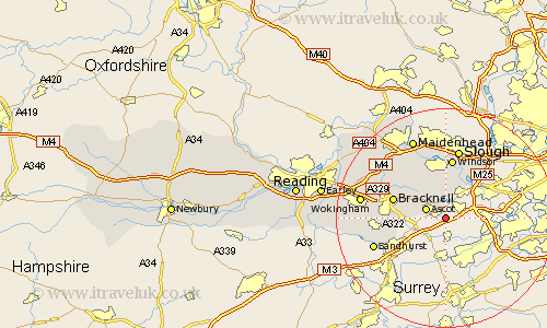
Berkshire Map Showing Location of Sunningdale
Population: 16378
Area Size (ha): 773
Easting: 496254 Northing: 165880
Latitude: 51.38 Longitude: -0.62
 = Sunningdale
Area Size (ha): 773
Easting: 496254 Northing: 165880
Latitude: 51.38 Longitude: -0.62
= Sunningdale
This Sunningdale map below is supplied by Google. Use the tools in the top left corner to zoom into street level or zoom out for a road map, you may also need to zoom in to see Sunningdale on the map. Click and drag the map to move around. If the map fails to load try and refresh your browser or zoom in or out (+ or -).
Update - it seems Google no longer allow people to use their maps for free! This Sunningdale map sometimes loads and sometimes gives a error. I am working on a solution.
Closest 30 Towns or Cities to Sunningdale (Population over 500)
Sunninghill 2.31km Ascot 3.94km Horton 7.77km Old Windsor 7.77km Winkfield 8.02km Wyrardisbury 8.74km Wraysbury 8.74km Warfield 8.9km Frogmore House 9.35km Frogmore 9.35km Datchet 9.9km Bracknell 9.97km Windsor 11.18km New Windsor 11.18km Colnbrook 11.58km Binfield 12.83km Eton 13.03km Slough 13.18km Sandhurst 13.89km Crowthorne 14km Bray 14.2km Stoke Poges 15.01km White Waltham 15.22km Wokingham 15.48km Waltham St. Lawrence 15.73km Waltham St Lawrence 15.73km Waltham Saint Lawrence 15.73km Maidenhead 15.92km Finchampstead 16.62km Winnersh 17.74km