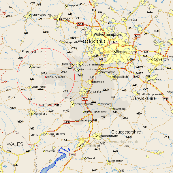
Worcestershire Map Showing Location of Tenbury
Population: 2173
Area Size (ha): 89
District: Malvern Hills
Easting: 360226 Northing: 267078
Latitude: 52.3 Longitude: -2.58
 = Tenbury
Area Size (ha): 89
District: Malvern Hills
Easting: 360226 Northing: 267078
Latitude: 52.3 Longitude: -2.58
= Tenbury
This Tenbury map below is supplied by Google. Use the tools in the top left corner to zoom into street level or zoom out for a road map, you may also need to zoom in to see Tenbury on the map. Click and drag the map to move around. If the map fails to load try and refresh your browser or zoom in or out (+ or -).
Update - it seems Google no longer allow people to use their maps for free! This Tenbury map sometimes loads and sometimes gives a error. I am working on a solution.
Closest 30 Towns or Cities to Tenbury (Population over 500)
Lindridge 8.15km Clifton upon Teme 12.63km Clifton 12.63km Rock 13km Abberley 14.73km Great Witley 15.98km Martley 16.5km Astley 18.13km Suckley 18.67km Bewdley 20.35km Arley 21.7km Upper Arley 21.7km Stourport on Severn 22.23km Stourport 22.23km Stourport-on-Severn 22.23km Leigh 22.32km Holt 23.35km Grimley 23.86km Hartlebury 24.08km Ombersley 24.09km Kidderminster 24.47km Hallow 24.51km Stone 27.08km Powick 27.11km Fernhill Heath 27.12km Great Malvern 27.31km Malvern 27.31km Worcester 28.37km Chaddesley Corbett 28.86km Malvern Wells 29.51km