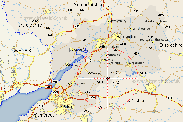
Gloucestershire Map Showing Location of Tetbury
Population: 4492
Area Size (ha): 129
District: Cotswold
Easting: 388465 Northing: 192786
Latitude: 51.63 Longitude: -2.17
 = Tetbury
Area Size (ha): 129
District: Cotswold
Easting: 388465 Northing: 192786
Latitude: 51.63 Longitude: -2.17
= Tetbury
This Tetbury map below is supplied by Google. Use the tools in the top left corner to zoom into street level or zoom out for a road map, you may also need to zoom in to see Tetbury on the map. Click and drag the map to move around. If the map fails to load try and refresh your browser or zoom in or out (+ or -).
Update - it seems Google no longer allow people to use their maps for free! This Tetbury map sometimes loads and sometimes gives a error. I am working on a solution.
Closest 30 Towns or Cities to Tetbury (Population over 500)
Avening 5.56km Nailsworth 6.02km Horsley 7.21km Minchinhampton 7.42km Woodchester 10.35km Chalford 11.12km Uley 11.75km Dursley 12.08km Wotton under Edge 12.65km Wotton-under-Edge 12.65km Hawkesbury 12.78km Stroud 13.18km Cam 14.66km Coaley 14.77km Stonehouse 15.27km North Nibley 15.4km Randwick 15.91km Siddington 15.95km Wickwar 15.96km Painswick 16.72km Cicester 16.83km Cirencester 16.83km Charfield 17.36km Slimbridge 17.58km South Cerney 17.64km Cerney 17.64km Chipping Sodbury 18.65km Falfield 19.55km Cromhall 19.64km Frampton on Severn 20.25km