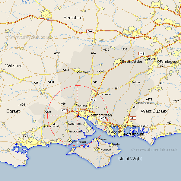
Hampshire Map Showing Location of Totton
Population: 25475
Area Size (ha): 633
District: New Forest
Easting: 436315 Northing: 113214
Latitude: 50.92 Longitude: -1.48
 = Totton
Area Size (ha): 633
District: New Forest
Easting: 436315 Northing: 113214
Latitude: 50.92 Longitude: -1.48
= Totton
This Totton map below is supplied by Google. Use the tools in the top left corner to zoom into street level or zoom out for a road map, you may also need to zoom in to see Totton on the map. Click and drag the map to move around. If the map fails to load try and refresh your browser or zoom in or out (+ or -).
Update - it seems Google no longer allow people to use their maps for free! This Totton map sometimes loads and sometimes gives a error. I am working on a solution.
Closest 30 Towns or Cities to Totton (Population over 500)
Totton 0km Eling 1.86km Marchwood 5.11km Southampton 5.85km Chilworth 5.96km Dibden 6.57km Cadnam 7.01km Itchen 7.25km Romsey 7.5km Hythe 8.07km West Wellow 8.94km Lyndhurst 8.95km Minstead 8.98km Bramshaw 9.53km Sherfield English 10.19km West End 10.52km Eastleigh 10.87km Bewley 11.36km Beaulieu 11.36km Ashurst 11.86km Bishopstoke 11.89km Netley 11.9km Netley Marsh 11.9km Hursley 12.56km Brockenhurst 12.56km Michlemersh 13.02km Michelmersh 13.02km Otterbourne 13.15km Hamble 13.85km Hample 13.85km