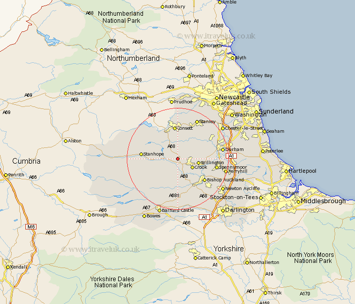
Durham Map Showing Location of Tow Law
Population: 2193
Area Size (ha): 50
District: Wear Valley
Easting: 411803 Northing: 537618
Latitude: 54.73 Longitude: -1.82
 = Tow Law
Area Size (ha): 50
District: Wear Valley
Easting: 411803 Northing: 537618
Latitude: 54.73 Longitude: -1.82
= Tow Law
This Tow Law map below is supplied by Google. Use the tools in the top left corner to zoom into street level or zoom out for a road map, you may also need to zoom in to see Tow Law on the map. Click and drag the map to move around. If the map fails to load try and refresh your browser or zoom in or out (+ or -).
Update - it seems Google no longer allow people to use their maps for free! This Tow Law map sometimes loads and sometimes gives a error. I am working on a solution.
Closest 30 Towns or Cities to Tow Law (Population over 500)
Wolsingham 4.66km Cornsay 6.42km Crook 6.51km Willington 7.72km Esh 9.32km High Etherley 10.21km Etherley 10.21km Lanchester 10.7km Castleside 11.57km Ushaw Moor 12.05km Langley Park 12.15km West Auckland 12.34km Stanhope 12.97km Brandon 12.97km Cockfield 13.01km Consetti 13.02km Consett 13.02km Coundon 13.02km Evenwood 13.36km Bishop Auckland 13.37km Witton Gilbert 13.9km Annfield Plain 14.03km Spennymoor 14.42km Leadgate 14.87km Shildon 15.44km Sacriston 15.83km Durham 16.47km Stanley 17.05km Edmondsley 17.51km Ferryhill 18.01km