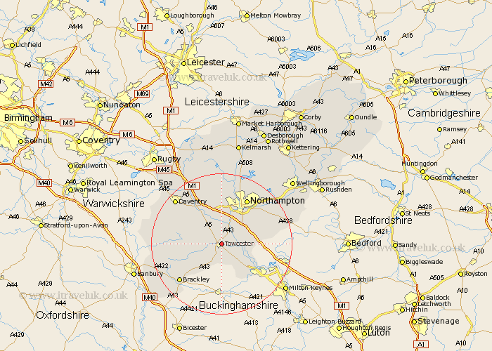
Northamptonshire Map Showing Location of Towcester
Population: 6888
Area Size (ha): 161
District: South Northamptonshire
Easting: 469579 Northing: 248865
Latitude: 52.13 Longitude: -0.98
 = Towcester
Area Size (ha): 161
District: South Northamptonshire
Easting: 469579 Northing: 248865
Latitude: 52.13 Longitude: -0.98
= Towcester
This Towcester map below is supplied by Google. Use the tools in the top left corner to zoom into street level or zoom out for a road map, you may also need to zoom in to see Towcester on the map. Click and drag the map to move around. If the map fails to load try and refresh your browser or zoom in or out (+ or -).
Update - it seems Google no longer allow people to use their maps for free! This Towcester map sometimes loads and sometimes gives a error. I am working on a solution.
Closest 30 Towns or Cities to Towcester (Population over 500)
Gayton 3.88km Pattishall 4.36km Blisworth 5.04km Whittlebury 5.56km Silverstone 6.01km Paulerspury 6.52km Roade 7.07km Milton 7.18km Bugbrooke 7.76km Collingtree 7.95km Wootton 8.8km Hartwell 9.1km Kislingbury 9.34km Syresham 10.07km Potterspury 10.08km Hardingstone 10.08km Weedon 10.88km Weedon Beck 10.88km Harpole 11.12km Helmdon 11.65km Flore 12.02km Hackleton 12.66km Denshanger 12.99km Deanshanger 12.99km Great Houghton 13.81km Houghton 13.81km Northampton 14.66km Greatworth 15.54km Brackley 15.92km Badby 16.49km