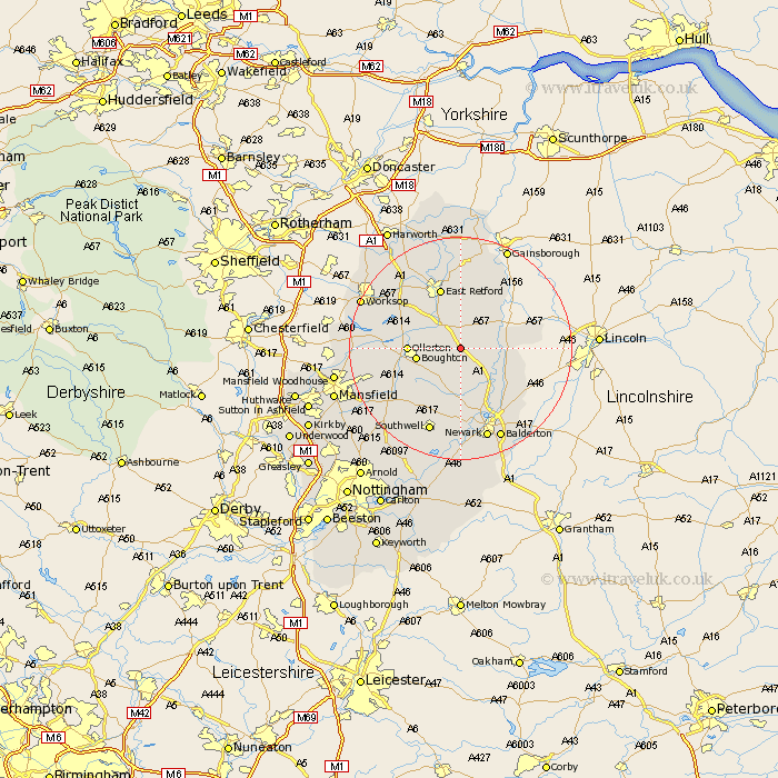
Nottinghamshire Map Showing Location of Tuxford
Population: 2503
Area Size (ha): 70
District: Newark and Sherwood
Easting: 474555 Northing: 369462
Latitude: 53.22 Longitude: -0.88
 = Tuxford
Area Size (ha): 70
District: Newark and Sherwood
Easting: 474555 Northing: 369462
Latitude: 53.22 Longitude: -0.88
= Tuxford
This Tuxford map below is supplied by Google. Use the tools in the top left corner to zoom into street level or zoom out for a road map, you may also need to zoom in to see Tuxford on the map. Click and drag the map to move around. If the map fails to load try and refresh your browser or zoom in or out (+ or -).
Update - it seems Google no longer allow people to use their maps for free! This Tuxford map sometimes loads and sometimes gives a error. I am working on a solution.
Closest 30 Towns or Cities to Tuxford (Population over 500)
Markham 3.7km East Markham 3.7km Walesby 6.91km Boughton 7.56km Elkesley 7.85km Elksley 7.85km Ollerton 8.88km Grove 9.33km Bampton 10.79km Rampton 10.79km Collingham 11.57km North Collingham 11.57km East Retford 11.61km North Leverton 11.97km Muskham 11.97km North Muskham 11.97km Edwinstowe 12.76km Bilsthorpe 13.64km Winthorpe 14.59km Clarborough 14.86km Hayton 14.86km Clipstone 15.47km Southwell 16.07km Sutton 16.25km Farnsfield 16.38km Newark-on-Trent 17.26km Newark on Trent 17.26km Newark upon Trent 17.26km Newark 17.26km Coddington 17.29km