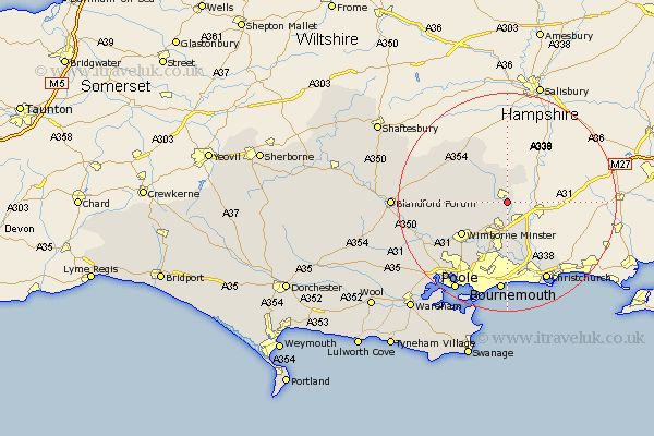
Dorset Map Showing Location of Verwood
Population: 8737
Area Size (ha): 312
District: East Dorset
Easting: 409381 Northing: 107536
Latitude: 50.87 Longitude: -1.87
 = Verwood
Area Size (ha): 312
District: East Dorset
Easting: 409381 Northing: 107536
Latitude: 50.87 Longitude: -1.87
= Verwood
This Verwood map below is supplied by Google. Use the tools in the top left corner to zoom into street level or zoom out for a road map, you may also need to zoom in to see Verwood on the map. Click and drag the map to move around. If the map fails to load try and refresh your browser or zoom in or out (+ or -).
Update - it seems Google no longer allow people to use their maps for free! This Verwood map sometimes loads and sometimes gives a error. I am working on a solution.
Closest 30 Towns or Cities to Verwood (Population over 500)
Saint Leonards 3.89km St. Leonards 3.89km St Leonards 3.89km Cranborne 5.1km Alderholt 6.03km West Moors 6.03km Horton 6.14km Fern Down 7.42km Ferndown 7.42km Wimborne Minster 10.34km Wimborne 10.34km West Parley 11.12km Parley 11.12km Handley 13.16km Corfe Mullen 14.93km Tarrant Monkton 15.2km Christchurch 16.41km Bournemouth 16.72km Sturminster Marshall 16.83km Burton 16.95km Spetisbury 18.41km Pimperne 18.8km Lytchett Matravers 19.13km Poole 19.13km Blandford 21.05km Blandford Forum 21.05km Arne 21.93km Holton Heath Station 22.59km Holton Heath 22.59km Charlton 22.75km