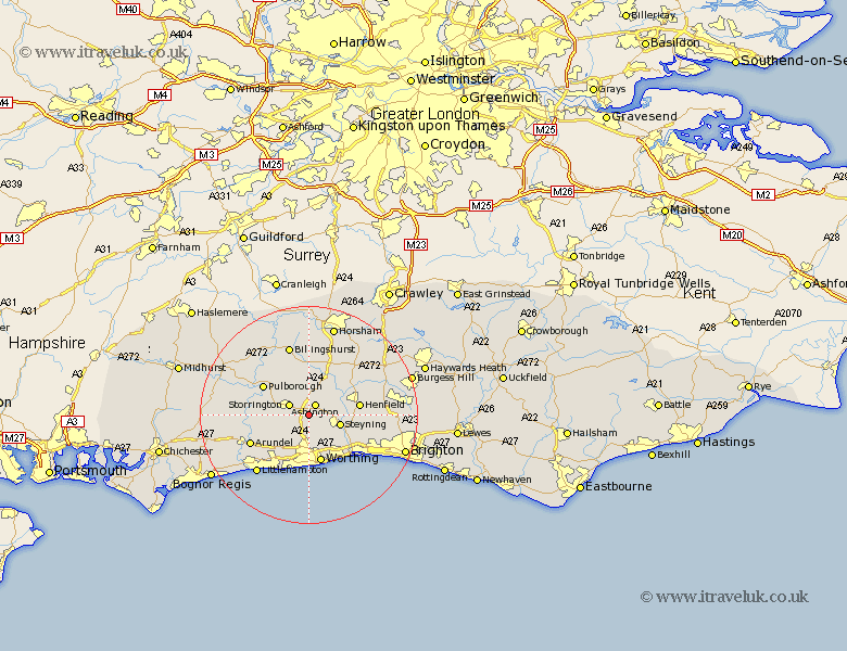
Sussex Map Showing Location of Washington
Population: 1930
District: Horsham
Easting: 512498 Northing: 112449
Latitude: 50.9 Longitude: -0.4
 = Washington
District: Horsham
Easting: 512498 Northing: 112449
Latitude: 50.9 Longitude: -0.4
= Washington
This Washington map below is supplied by Google. Use the tools in the top left corner to zoom into street level or zoom out for a road map, you may also need to zoom in to see Washington on the map. Click and drag the map to move around. If the map fails to load try and refresh your browser or zoom in or out (+ or -).
Update - it seems Google no longer allow people to use their maps for free! This Washington map sometimes loads and sometimes gives a error. I am working on a solution.
Closest 30 Towns or Cities to Washington (Population over 500)
Ashington 2.19km Thakeham 3.88km Storrington 4.04km West Chillington 5.1km West Chiltington 5.1km Findon 5.56km Steyning 6.13km Bramber 6.13km Upper Beeding 6.13km Upper Bleeding 6.13km Shipley 7.78km West Grinstead 8.77km Worthing 9.2km Henfield 9.53km Amberley 9.53km Pulborough 9.89km Sompting 9.91km Coldwaltham 10.05km Lancing 10.38km North Lancing 10.38km Angmering 10.95km Ferring 11.66km West Ferring 11.66km Bury 11.69km Arundel 11.9km Fittleworth 12.94km Nuthurst 13.14km Rustington 13.15km Cowfold 13.16km Southwater 13.44km