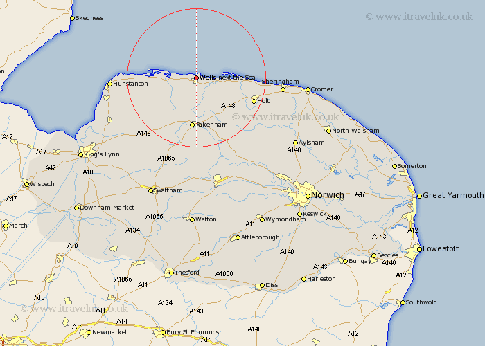
Norfolk Map Showing Location of Wells On Sea
Population: 2403
Area Size (ha): 87
District: North Norfolk
Easting: 591371 Northing: 344873
Latitude: 52.97 Longitude: 0.85
 = Wells On Sea
Area Size (ha): 87
District: North Norfolk
Easting: 591371 Northing: 344873
Latitude: 52.97 Longitude: 0.85
= Wells On Sea
This Wells On Sea map below is supplied by Google. Use the tools in the top left corner to zoom into street level or zoom out for a road map, you may also need to zoom in to see Wells On Sea on the map. Click and drag the map to move around. If the map fails to load try and refresh your browser or zoom in or out (+ or -).
Update - it seems Google no longer allow people to use their maps for free! This Wells On Sea map sometimes loads and sometimes gives a error. I am working on a solution.
Closest 30 Towns or Cities to Wells On Sea (Population over 500)
Burnham Market 8.03km Little Walsingham 9.54km Walsingham 9.54km Blakeney 10.05km South Creake 10.83km Sculthorpe 13.17km Brancaster 13.39km Little Snoring 13.4km Fakenham 14.88km Syderstone 15.76km Tatterset 16.77km Tattersett 16.77km Ryburgh 17.27km Great Ryburgh 17.27km Docking 17.31km Holt 17.31km Melton Constable 17.88km Mellon Constable 17.88km Colkirk 18.54km East Rudham 18.93km Bircham 19.48km Great Bircham 19.48km Briston 19.48km Hindolveston 20.08km Weybourne 20.44km Sedgeford 21.43km Foulsham 23.26km Foulham 23.26km Hunstanton 23.52km Sheringham 23.74km