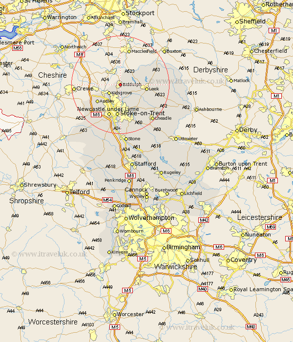
Staffordshire Map Showing Location of Biddulph
Population: 16476
Area Size (ha): 388
District: Staffordshire Moorlands
Easting: 388845 Northing: 357770
Latitude: 53.12 Longitude: -2.17
 = Biddulph
Area Size (ha): 388
District: Staffordshire Moorlands
Easting: 388845 Northing: 357770
Latitude: 53.12 Longitude: -2.17
= Biddulph
This Biddulph map below is supplied by Google. Use the tools in the top left corner to zoom into street level or zoom out for a road map, you may also need to zoom in to see Biddulph on the map. Click and drag the map to move around. If the map fails to load try and refresh your browser or zoom in or out (+ or -).
Update - it seems Google no longer allow people to use their maps for free! This Biddulph map sometimes loads and sometimes gives a error. I am working on a solution.
Closest 30 Towns or Cities to Biddulph (Population over 500)
Biddulph 0km Endon 4.99km Horton 5.56km Kidsgrove 5.8km Leek 10.18km Audley 11.59km Cheddleton 11.59km Stoke upon Trent 13.02km Stoke 13.02km Stoke-upon-Trent 13.02km Stoke on Trent 13.02km Stoke-on-Trent 13.02km Silverdale 13.58km Newcastle-under-Lyme 13.72km Newcastle under Lyme 13.72km Keele 15.14km Betley 16.26km Ipstones 16.26km Caverswall 16.27km Kingsley 16.54km Madeley 17.1km Whitmore 18.41km Barlaston 18.54km Draycott in the Moors 18.91km Draycott 18.91km Cheadle 19.24km Fulford 19.71km Oakamoor 21.15km Waterhouses 22.08km Swynnerton 22.49km