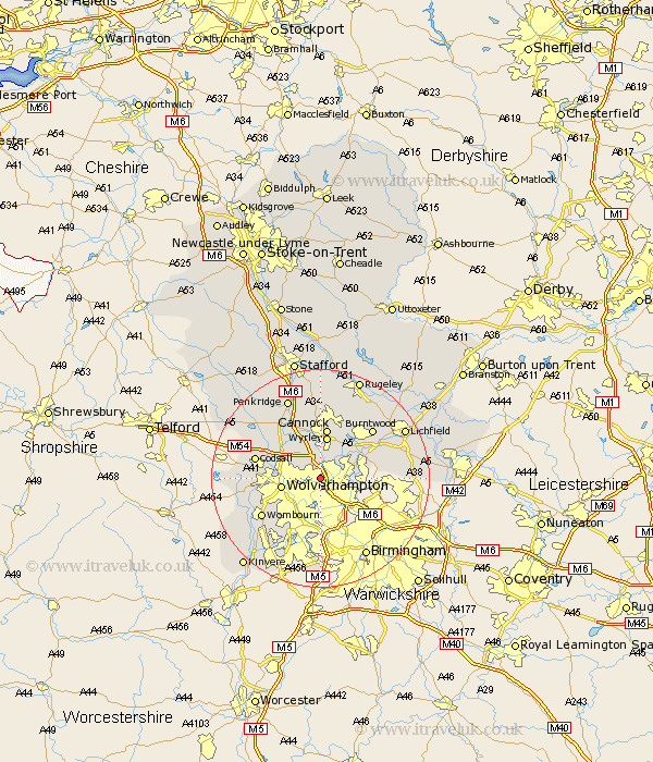
Staffordshire Map Showing Location of Willenhall
District: Walsall
Easting: 397742 Northing: 300285
Latitude: 52.6 Longitude: -2.03
 = Willenhall
Easting: 397742 Northing: 300285
Latitude: 52.6 Longitude: -2.03
= Willenhall
This Willenhall map below is supplied by Google. Use the tools in the top left corner to zoom into street level or zoom out for a road map, you may also need to zoom in to see Willenhall on the map. Click and drag the map to move around. If the map fails to load try and refresh your browser or zoom in or out (+ or -).
Update - it seems Google no longer allow people to use their maps for free! This Willenhall map sometimes loads and sometimes gives a error. I am working on a solution.
Closest 30 Towns or Cities to Willenhall (Population over 500)
Walsall 2.25km Wallsall 2.25km Bilston 4.33km Rushall 5.63km Pelsall 5.93km Wolverhampton 7.01km Brownhills 7.7km Wyrley 7.79km Great Wyrley 7.79km Aldridge 7.88km Shareshill 8.15km Cannock 9.33km West Bromwich 9.53km Norton Canes 10.3km Huntington 11.12km Hednesford 11.34km Smethwick 11.35km Hammerwich 11.55km Dudley 11.62km Codsall 11.85km Lower Penn 11.85km Himley 12.17km Wombourn 12.56km Wombourne 12.56km Burntwood 12.91km Brewood 12.91km Shenstone 14km Seisdon 15.1km Scisdon 15.1km Penkridge 15.85km