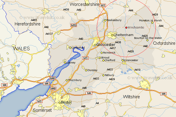
Gloucestershire Map Showing Location of Winchcombe
Population: 4274
Area Size (ha): 104
District: Tewkesbury
Easting: 403436 Northing: 227994
Latitude: 51.95 Longitude: -1.95
 = Winchcombe
Area Size (ha): 104
District: Tewkesbury
Easting: 403436 Northing: 227994
Latitude: 51.95 Longitude: -1.95
= Winchcombe
This Winchcombe map below is supplied by Google. Use the tools in the top left corner to zoom into street level or zoom out for a road map, you may also need to zoom in to see Winchcombe on the map. Click and drag the map to move around. If the map fails to load try and refresh your browser or zoom in or out (+ or -).
Update - it seems Google no longer allow people to use their maps for free! This Winchcombe map sometimes loads and sometimes gives a error. I am working on a solution.
Closest 30 Towns or Cities to Winchcombe (Population over 500)
Alderton 5.04km Southam 7.1km Dumbleton 7.5km Bishops Cleeve 8km Andoversford 9.26km Swindon 10.45km Cheltenham 10.7km Charlton Kings 12.24km Ashchurch 12.7km Withington 12.98km Leckhampton 13.02km Chipping Campden 14.7km Shurdington 14.72km Tewkesbury 14.78km Stow on the Wold 14.97km Stow-on-the-Wold 14.97km Staverton 15.31km Blockley 15.58km Northleach 15.88km Bourton on the Water 16.55km Bourton-on-the-Water 16.55km Churchdown 16.61km Chedworth 16.84km Deerhurst 17.23km Moreton-in-Marsh 17.52km Moreton in the Marsh 17.52km Moreton in Marsh 17.52km Ebrington 18.54km Brockworth 18.57km Innsworth 18.68km