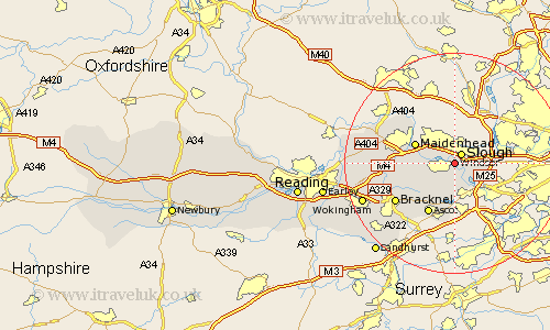
Berkshire Map Showing Location of New Windsor
Population: 30554
Area Size (ha): 746
Easting: 497201 Northing: 177021
Latitude: 51.48 Longitude: -0.6
 = New Windsor
Area Size (ha): 746
Easting: 497201 Northing: 177021
Latitude: 51.48 Longitude: -0.6
= New Windsor
This New Windsor map below is supplied by Google. Use the tools in the top left corner to zoom into street level or zoom out for a road map, you may also need to zoom in to see New Windsor on the map. Click and drag the map to move around. If the map fails to load try and refresh your browser or zoom in or out (+ or -).
Update - it seems Google no longer allow people to use their maps for free! This New Windsor map sometimes loads and sometimes gives a error. I am working on a solution.
Closest 30 Towns or Cities to New Windsor (Population over 500)
Frogmore House 1.85km Frogmore 1.85km Eton 1.86km Slough 2.19km Datchet 2.96km Old Windsor 3.88km Horton 3.88km Stoke Poges 3.89km Wyrardisbury 5.07km Wraysbury 5.07km Colnbrook 6.06km Bray 7.17km Maidenhead 7.85km Winkfield 8.88km Cookham 10.14km Ascot 10.35km Sunningdale 11.18km White Waltham 11.54km Sunninghill 11.65km Warfield 11.84km Bracknell 12.76km Bisham 13.71km Binfield 13.86km Waltham St. Lawrence 13.97km Waltham St Lawrence 13.97km Waltham Saint Lawrence 13.97km Hurley 15.99km Twyford 17.41km Wokingham 17.78km Wargrave 18.47km