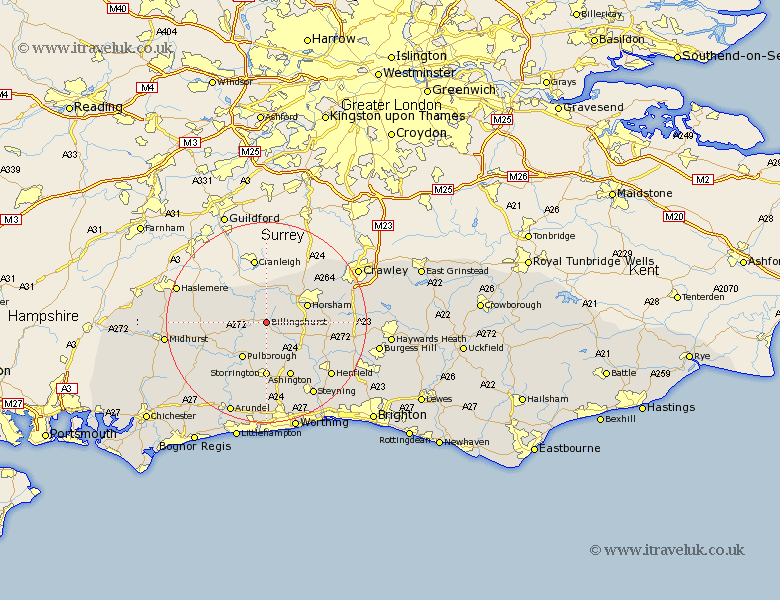
Sussex Map Showing Location of Billingshurst
Population: 4841
Area Size (ha): 130
District: Horsham
Easting: 508710 Northing: 125350
Latitude: 51.02 Longitude: -0.45
 = Billingshurst
Area Size (ha): 130
District: Horsham
Easting: 508710 Northing: 125350
Latitude: 51.02 Longitude: -0.45
= Billingshurst
This Billingshurst map below is supplied by Google. Use the tools in the top left corner to zoom into street level or zoom out for a road map, you may also need to zoom in to see Billingshurst on the map. Click and drag the map to move around. If the map fails to load try and refresh your browser or zoom in or out (+ or -).
Update - it seems Google no longer allow people to use their maps for free! This Billingshurst map sometimes loads and sometimes gives a error. I am working on a solution.
Closest 30 Towns or Cities to Billingshurst (Population over 500)
Wisborough Green 3.5km Itchingfield 5.01km Slinfold 5.09km Kirdford 6.99km Southwater 6.99km Loxwood 7.25km Shipley 8.06km Pulborough 8.76km Horsham 8.96km West Horsham 8.96km Plaistow 8.96km West Chiltington 9.27km West Chillington 9.27km Rudgwick 9.33km Thakeham 9.56km West Grinstead 9.88km Nuthurst 10.66km Coldwaltham 10.96km Storrington 10.98km Warnham 11.02km Fittleworth 11.03km Petworth 11.13km Ashington 12.06km Tillington 12.24km Amberley 12.56km North Chapel 13.34km Northchapel 13.34km Cowfold 13.36km Washington 13.44km Lower Beeding 13.99km