Nottinghamshire Map Showing Location of Worksop
Population: 37141
Area Size (ha): 994
District: Bassetlaw
Easting: 457752 Northing: 378497
Latitude: 53.3 Longitude: -1.13
 = Worksop
Area Size (ha): 994
District: Bassetlaw
Easting: 457752 Northing: 378497
Latitude: 53.3 Longitude: -1.13
= Worksop
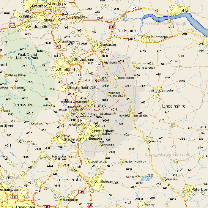
This Worksop map below is supplied by Google. Use the tools in the top left corner to zoom into street level or zoom out for a road map, you may also need to zoom in to see Worksop on the map. Click and drag the map to move around. If the map fails to load try and refresh your browser or zoom in or out (+ or -).
Update - it seems Google no longer allow people to use their maps for free! This Worksop map sometimes loads and sometimes gives a error. I am working on a solution.
Closest 30 Towns or Cities to Worksop (Population over 500)
Worksop 0km Shireoaks 2.89km Blyth 8.64km Ramskill 10.72km Ranskill 10.72km Warsop 11.17km Sutton 11.41km Styrrup 11.6km Elksley 11.68km Elkesley 11.68km Ollerton 12.08km Walesby 12.43km East Retford 13.42km Harworth 13.71km Edwinstowe 13.71km Bircotes 14.11km Boughton 14.51km Clipstone 14.99km Mansfield Woodhouse 15.47km Grove 15.51km Mattersey 15.68km Hayton 16.46km Clarborough 16.46km Everton 16.48km Pleasley 16.73km East Markham 17.53km Markham 17.53km Tuxford 19.03km Mansfield 19.06km Gringley-on-the-Hill 19.07km